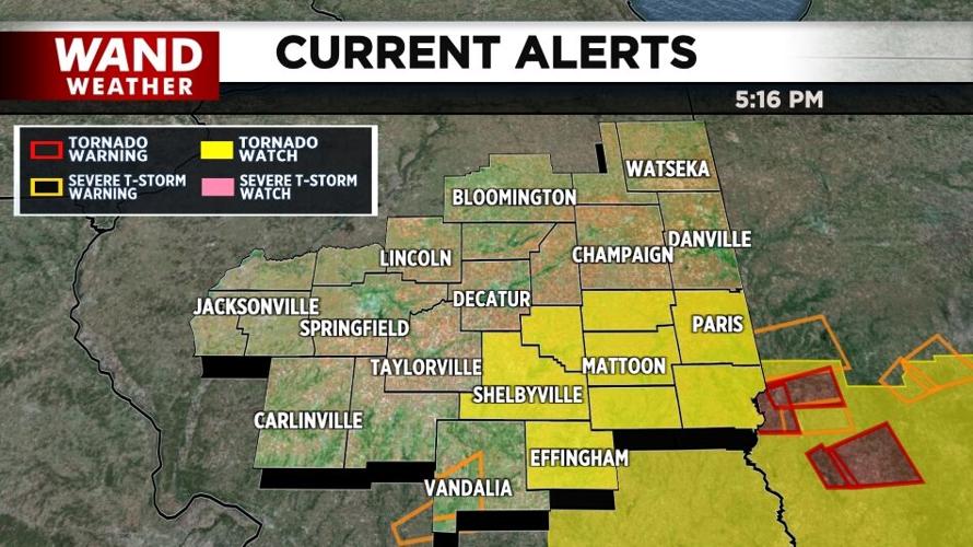


DECATUR, Ill. (WAND) - The National Weather Service has issued a Tornado Watch for some areas of central and southern Illinois Thursday.
The Storm Prediction Center issued the watch for Coles, Cumberland, Edgar, Effingham, and Moultrie counties until 8 p.m. CT.

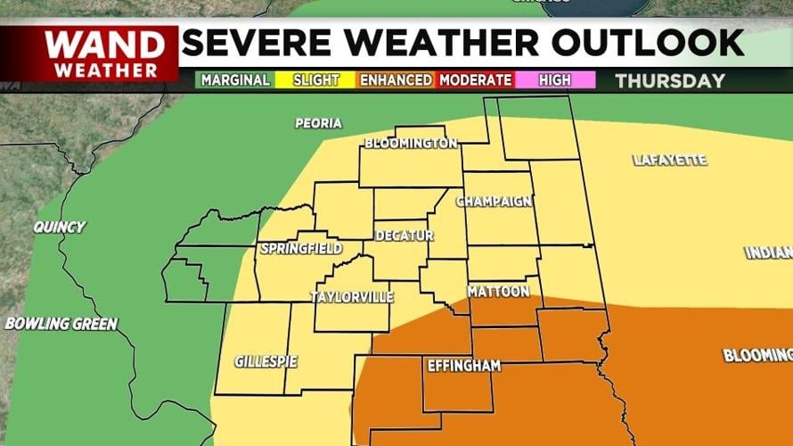
The severe weather risk as determined by the National Weather Service for Illinois on Feb. 19, 2026. (WAND Weather)
NWS said tornadoes are possible, some severe and strong. Hail is also possible and some areas could see hail sizes bigger than walnuts. Wind gusts could also reach 60 to 70 miles per hour.
Storms Thursday afternoon produced several tornado warnings in southeast Illinois.
TRACK THE STORMS | Click here for a weather radar to keep an eye on the storms
The WAND Weather Team has been expecting severe weather for several days. An enhanced risk (3 of 5) is in place for most of Central Illinois.
Following the storms, temperatures are expected to drop into the 30s and 40s for the next several days.
Top Stories:
Police: Man killed woman by 'jokingly' pointing AR15 at her and firing
IKEA plans to open new store in Illinois
Former Gibson City teacher, coach pleads guilty to sexual abuse of a child
Decatur Council declines additional funds for 24-hour daycare project, owner vows to press on
Copyright 2026. WAND TV. All rights reserved.