


DECATUR, Ill. (WAND) - The dictionary defines the jet stream as strong, generally westerly winds concentrated in a relatively narrow and shallow stream in the upper troposphere of the Earth.
Meh.
A better definition is that the jet stream is the bus driver for storms along with associated hot/cold patterns across the northern hemisphere.
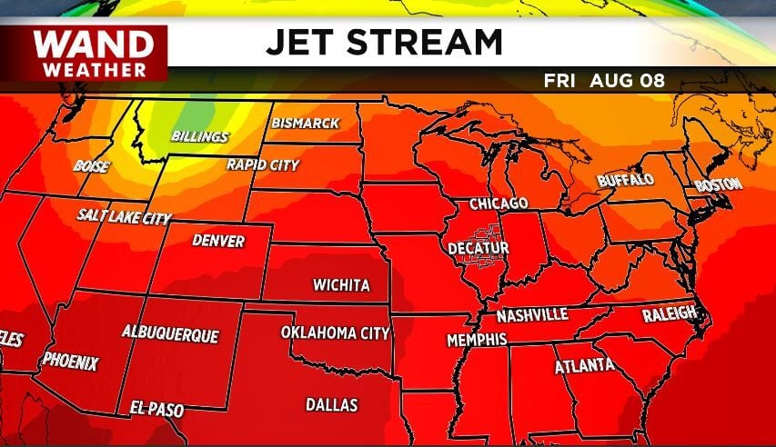
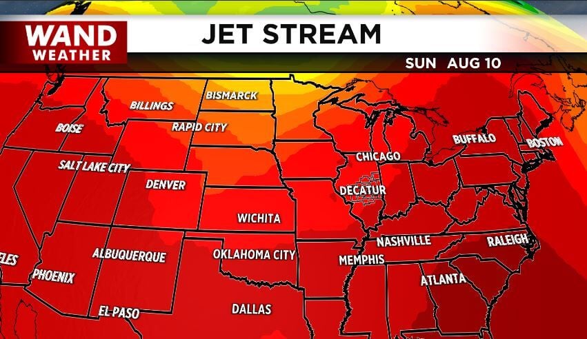
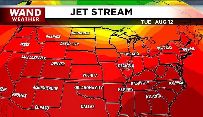
So, when we take a look at the jet stream for this Friday, note the heat (red color) across the nation. While a few spots can get wet briefly, most of our next storm is situated in the Northern US Rockies and Canadian Rockies (green/yellow). Take note of what happens to that greenish/yellow area by this Sunday and then Tuesday next week. It flattens out and stays primarily to our north. This means no relief in humidity any time soon. However, as the pressure lowers a bit in advance of that storm, it will be able to kick off occasional thunderstorms, most of which will be next week.
In the short term, stay weather aware, stay safe out there and stay sweaty.
Copyright 2025. WANDTV. All Rights Reserved.


