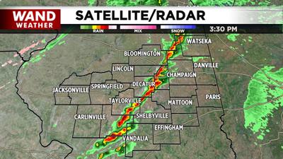
DECATUR, Ill. (WAND) - As forecasted, severe weather is moving across central Illinois on Sunday afternoon.
The National Weather Service put most of central Illinois under a Tornado Watch until 8 p.m. CT.
As of 3 p.m. Sunday, several tornado warnings had already been issued, including in Christian County and in Macon County.
So far, there have been no reports of major damage or injuries.
A cold front moving across Illinois is expected to produce strong storms with possible tornadoes and damaging wind gusts. Following the front, temperatures are expected to plummet more than 20 to 30 degrees in some areas.
Sunday high temperatures reached the 60's with higher than normal humidity for late December. Temperatures Sunday evening are expected to be in the 20's, according to the WAND Weather team.
Copyright 2025. WAND TV. All rights reserved.