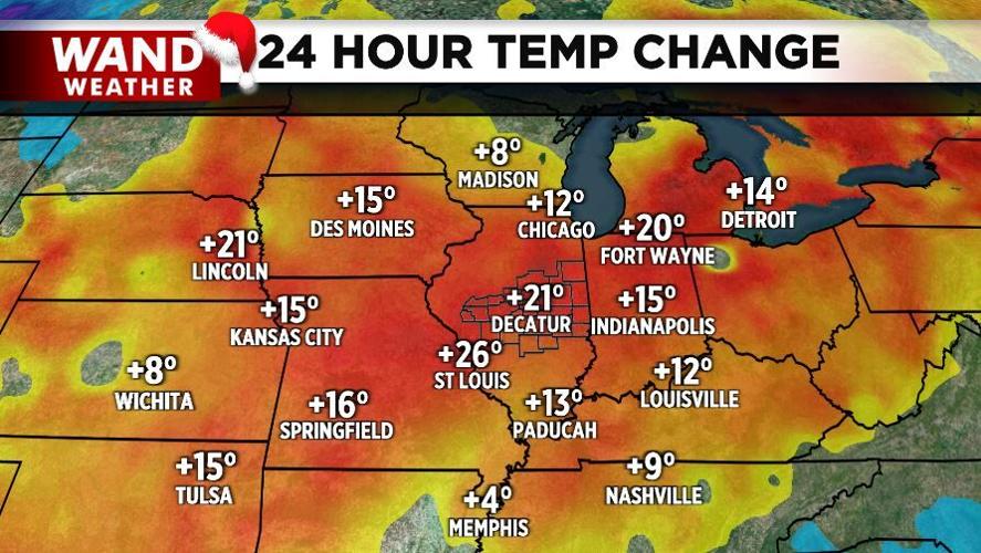
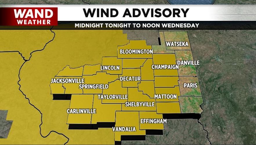

DECATUR, Ill. (WAND) - Today's warmer weather was most certainly tempered by the wind. The wind, developing from a change in pressure, is accompanied by the passage of a cold front early Wednesday.
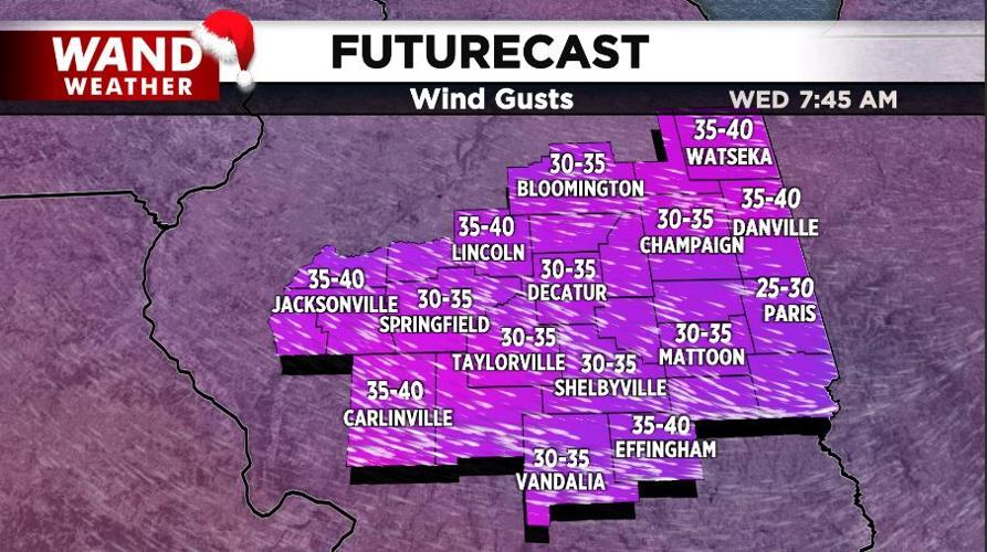
Colder weather will once again haunt us before the official arrival of winter on the 21st. The worst of this round of cold will take place over the weekend. Before then, wind gusts will be primarily in the 20s and 30s through Wednesday. However, peak gusts will eclipse 40 mph, leading to minor damage in spots.
As far as precipitation is concerned, it'll be fairly minor. A few hit/miss rain showers tonight will give way to a snow shower Wednesday morning. The visibility may dip briefly in any snow shower as the wind will whip it around at breakneck speed.
Stay safe, stay warm, and stay weather-aware.
Copyright 2025. WANDTV. All Rights Reserved.


