

(WAND WEATHER) - Wednesday's cold front that helped ignite several tornadoes across central Illinois continues to haunt us despite being nearly stationary over southern Illinois.
As warm, moist air from the Gulf Coast travels over the top of said front, rain and thunderstorms continue to form, leading to pockets of heavy rain.

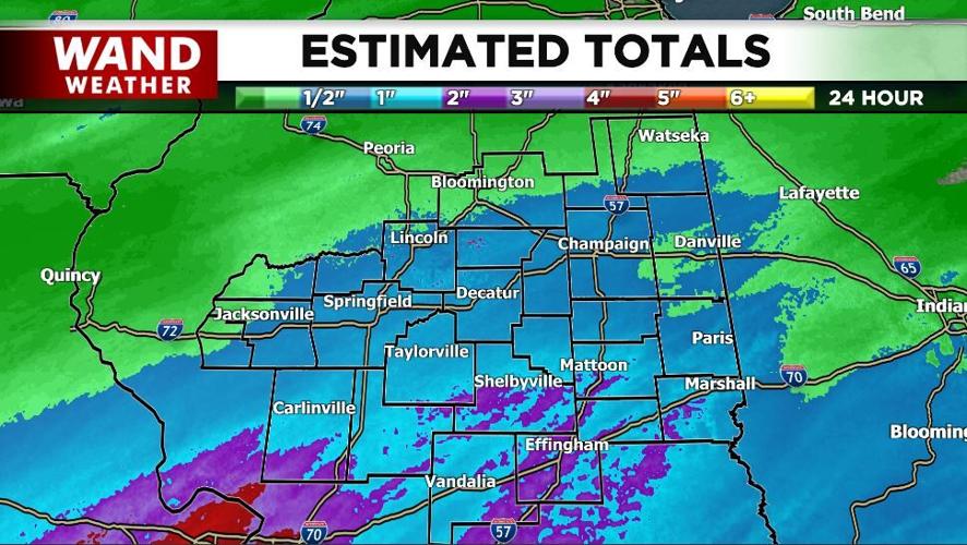
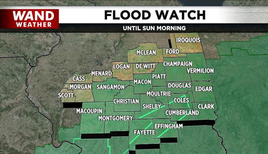
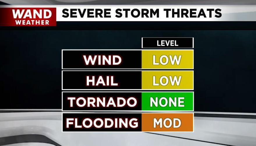
Several areas have reported being under water from Coles county southward with over 2" of rain today. So, while the risk of damaging wind gusts and hail are quite low and tornadic activity remains south, ponding of water will be the biggest weather issue we face.

Rain will taper off overnight but expect a few more hours of the wet stuff early on this weekend.
Copyright 2025. WANDTV. All Rights Reserved.


