

DECATUR, IL. (WAND) - Happy Sunday! The week starts off on a muggy, warm, and wet note, and more heat, humidity, and rain are on the way for the work week.
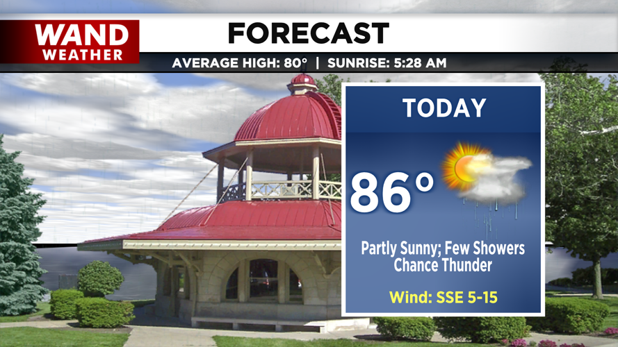
Light showers pass through this morning and afternoon. A few rumbles of thunder can’t be ruled out, but our severe potential is virtually none. Temperatures top off in the mid-80s.

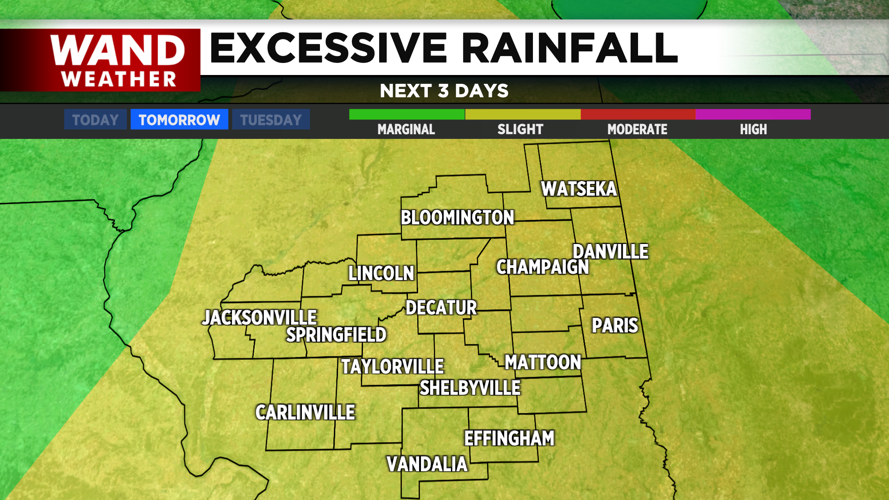
A few isolated thunderstorms are possible this evening; otherwise, better chances for more widely scattered showers and storms move in early tomorrow morning. We’ll keep the storms around throughout the day and into the evening, and the last of the showers may linger as long as into early Tuesday. Slow storm movement may allow for ponding and flash flooding concerns in areas with poor drainage.

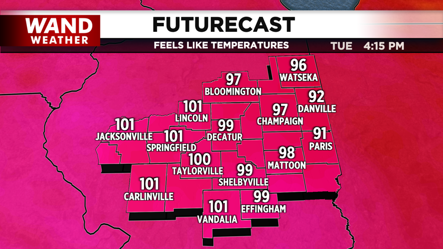
By midweek, we’ll be shifting our focus to high heat and humidity. Air temperatures in the low 90s will feel more like upper 90s and low 100s due to high dewpoints.
Stay cool and have a great day!
Copyright 2026. WANDTV. All Rights Reserved.


