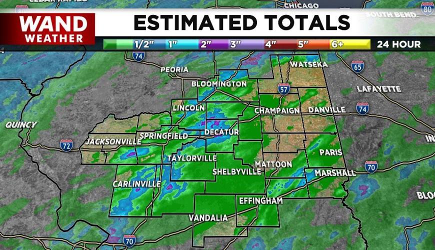


DECATUR, Ill. (WAND) - Heavy, slow-moving storms rolled through parts of Central Illinois this afternoon and evening. They were triggered in part by an approaching cool front that will help ease the heat/humidity throttle, at least for 48 hours.
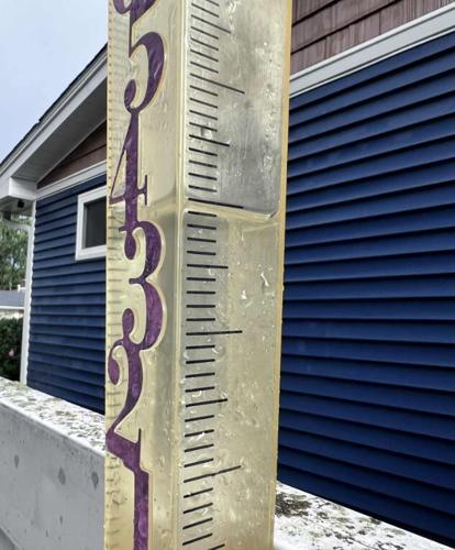
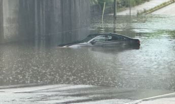
Unfortunately, the rain was too much, too fast in a few spots, and flooding developed. Doppler estimate rainfall amounts were over three inches in a few counties. Larry shared a picture of his rain gauge approaching three inches on the north side of Decatur. Most of that rain fell in one hour!
When it rains that hard, you have to keep in mind the adage, "turn around, don't drown." We have a lot of train tracks across our area. That means some roads slope sharply down to cross underneath the tracks, with the end result being flooding.
Be smart out there, and stay safe and weather aware.
Copyright 2025. WANDTV. All Rights Reserved.


