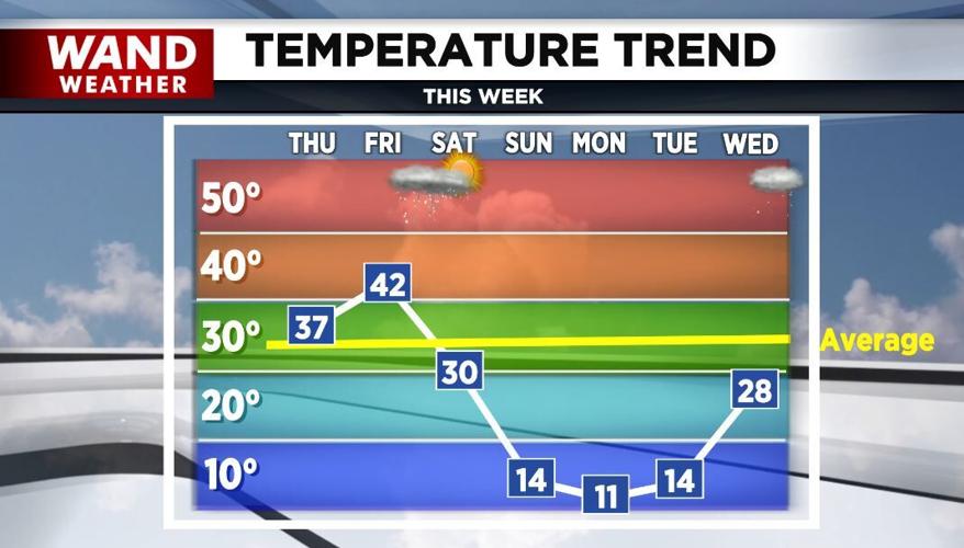


(WAND) - Central Illinois will enjoy a brief warm-up before it turns bitterly cold again.
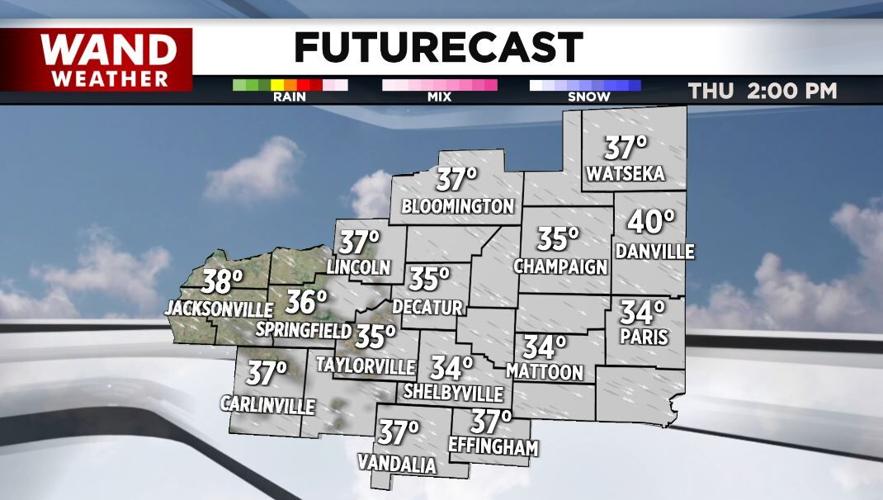
Under a sun and cloud mix today, highs will warm well into the 30s. However, breezy conditions will put a chill in the air.

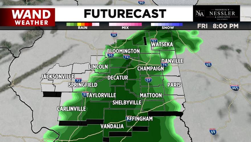
Snow melt today could produce some patchy freezing fog tonight and early Friday across our southern hometowns.
Friday will be the warmest day of the week with highs in the low-40s.
Rain moves in by evening and continues into Saturday morning. The rain could end as light snow as much colder invades again.
Saturday will be breezy with falling temperatures.

Highs Sunday through Tuesday will only be around 10°-15° with overnight lows dropping near or below zero. The winds will make it feel much colder.
Meteorologist Anthony Peoples
Copyright 2025 WAND TV. All rights reserved.


