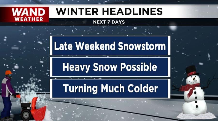


(WAND) - Winter will definitely take over for the first half of January across central Illinois.
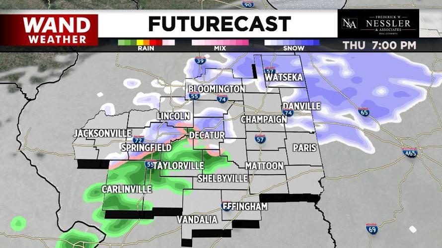
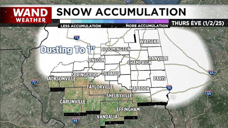
A disturbance will drop through the area this afternoon and early tonight and bring a light wintry mix. Across the northeastern half of the area, a dusting to an inch of snow is possible.
This clipper system will usher in much colder air with highs in the 20s tomorrow through Monday. Overnight lows will be in the teens.
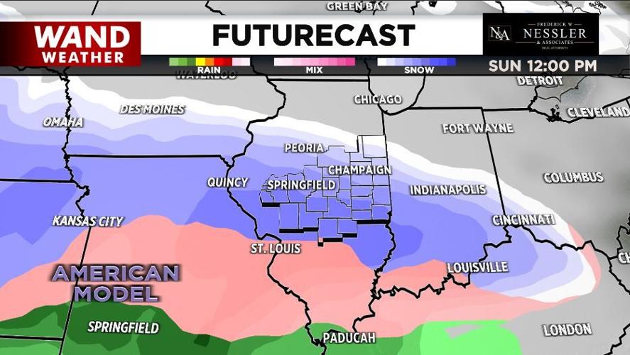
Friday and Saturday will be the "calm before the storm".
It's looking more and more likely that moderate to heavy snow will blanket central Illinois late this weekend into Monday.
While it's still too early for specific snowfall forecasts, accumulations are looking to be heavy.
Bitterly cold air follows next week with highs only in the teens and lows in the single digits — above and below zero.
Meteorologist Anthony Peoples
Copyright 2025 WAND TV. All rights reserved.


