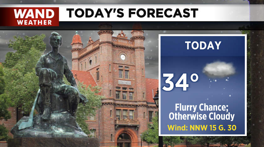
(WAND WEATHER)- Central Illinois woke up to a snow flurries/showers Friday morning leaving many with a dusting, but some even picked up close to 0.25”.
Morning commutes were impacted by a few slick spots, but roads remain mostly clear.

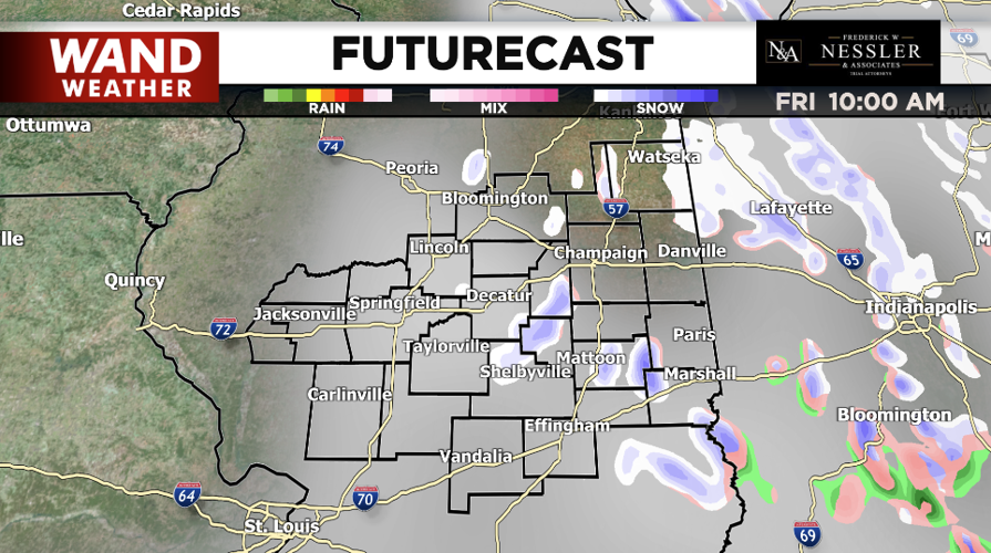
Futurecast shows the potential to see flurries throughout the day, however, majority of Central Illinois will just see cloudy conditions.
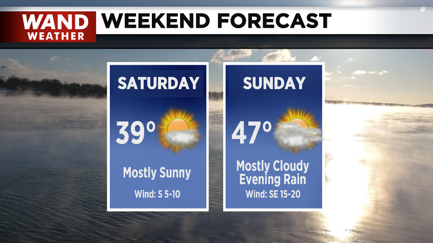
Sunshine returns for the holiday weekend, but warm will be put on hold. Highs only near 40° Saturday with cloud cover increasing into Sunday, where some rain chances could popup in the evening.
Sunday’s rain chances will become widespread going into Martin Luther King Jr. Day (Monday). While some are off on Monday, many will need the umbrella as the upcoming work week begins.
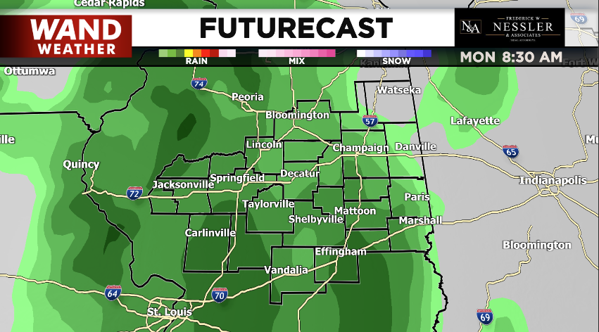
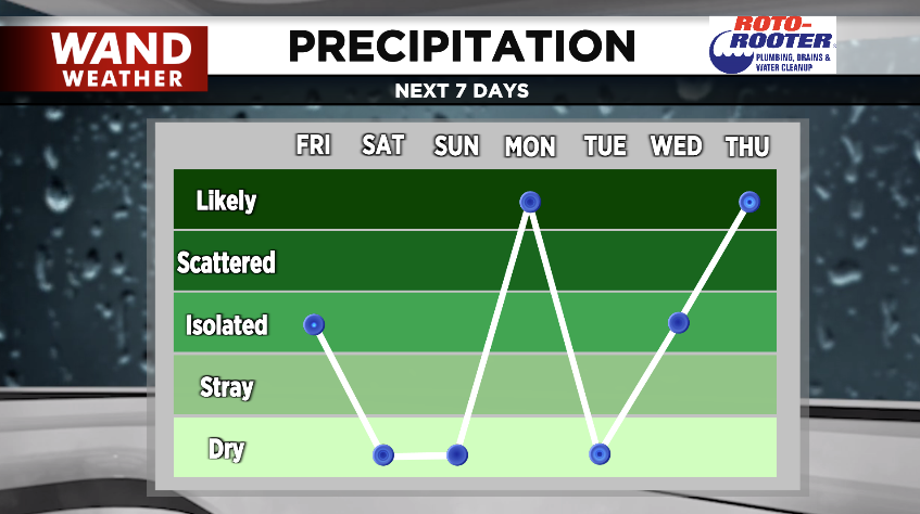
Monday isn’t the only chance of rain in the forecast.
Wednesday afternoon/evening could see a few isolated chances which, once again, become likely throughout Thursday.
Keep the umbrella and raincoat/boots handy throughout the next 7-days.
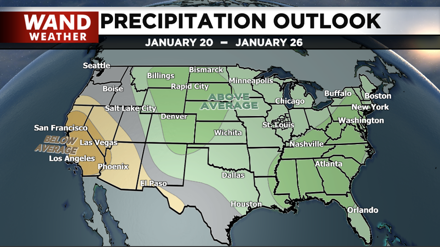
The first half of January has been a relatively warm start in comparison to our average. It’s also been above average for precipitation. Little change is expected on the 8–14-day period.

The Precipitation Outlook does not show rain vs snow chances. However, it is safe to assume majority of those chances will be in the form of rain, right now, since temperatures look to remain above average.
Copyright 2023. WANDTV. All Rights Reserved.


