


(WAND) - A cold front passed through central Illinois on Sunday, which will bring very cold temperatures for the start of the workweek.
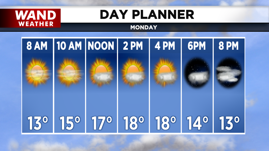
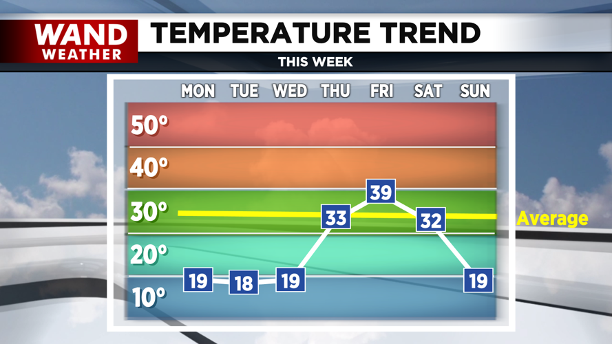
Highs starting today through Wednesday will be at or near 20°, which is almost 15° below average. Skies for today will be mostly sunny, with clouds increasing for tonight.

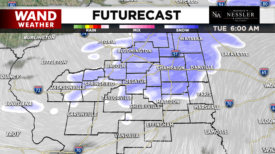
A quick clipper system will arrive early on Tuesday bringing spotty snow showers. Snowfall amounts are trending to be around a half inch, with clouds decreasing throughout the rest of Tuesday. Nighttime temperatures will be around 10° for tonight and Wednesday, while Tuesday night will be the coldest around 0°. However, a light breeze could drop feels like temperatures subzero over the next few nights.
Temperatures begin to rebound on Thursday, with temperatures around freezing in the low 30s & will continue to warm towards 40° by Friday. Skies will be mostly sunny on Thursday & partly cloudy by Friday with breezy conditions. Temperatures above freezing during day will lead to snowmelt which will refreeze night causing some slick or icy spots on road & sidewalks.

A new system is forecasted for the start of the weekend on Friday night in the form of rain. The rain will gradually begin to turn into a mix or even snow as it gradually tapers off on Saturday.
Stayed for more updates throughout the week. Lastly, temperatures will dip by Saturday to around freezing in the low 30s and tumble to near 20° by Sunday, under mostly cloudy skies.
Meteorologist Ulises Garcia
Copyright 2025 WAND TV. All rights reserved.


