


DECATUR, Ill. (WAND) - The National Weather Service confirmed 5 tornadoes touched down as storms made their way across central Illinois on Wednesday.
The tornadoes ranged from EF-0 to EF-2, with the strongest winds reaching speeds up to 135 mph.
NWS reported an EF-0 touched down just west of Cissna Park, three EF-1 tornadoes, one in Lincoln, one southeast of Loda, another in Montrose, Effingham Co., and an EF-2 reported near Vandalia Lake in Fayette Co.
Damage survey crews from Lincoln said Thursday the tornado had peak winds of 105 miles per hour, was 125 yards wide, and was on the ground for roughly three minutes.
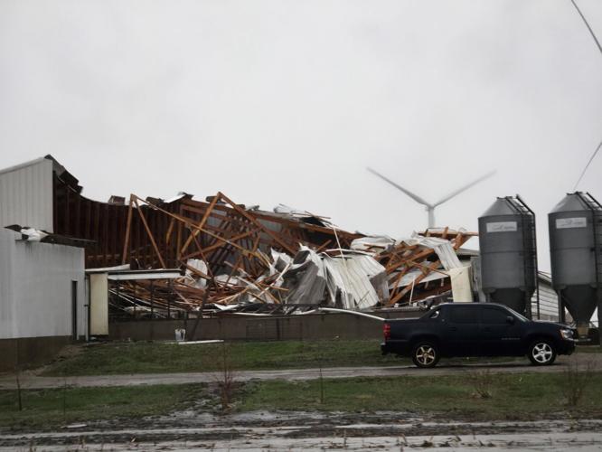
The tornado was a few miles southeast of Altamont. NWS reported that a roof was ripped off a home and trees were damaged along the tornado's path. WAND's Carlee Bronkema spoke to the homeowner who lost part of his roof.
Damage surveys in Effingham County were expected to continue on Thursday, as well as surveys in Clark and Cumberland counties.
Wednesday's weather spawned at least 15 Tornado Warnings across central Illinois Wednesday and nearly two dozen Thunderstorm Warnings, according to the WAND Weather Team. Parts of the area reported wind gusts between 50 and 80 miles per hour.
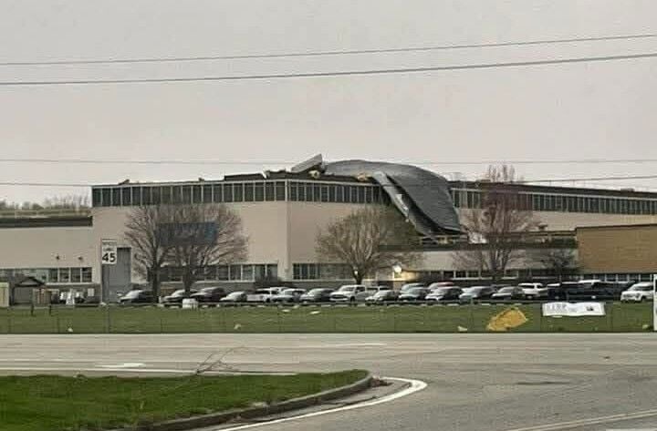
An early round of storms Wednesday morning tore the roof of the Eaton Corporation in Lincoln. Afternoon storms toppled trees, knocked down power lines, and caused damage to some homes and farming buildings in several counties.
At 10 p.m. Wednesday, more than 7,000 customers were without power in Illinois. A large number of outages were reported along the I-70 corridor stretching though Effingham, Cumberland, Clark, and Edgar counties. By Thursday morning, most of the power had been restored.
Iroquois County Emergency Management said significant storm damage was found near Loda along County Road 100 North Road and 500 East Road.
"Heavy damage to several structures on two separate properties, on both sides of the intersection, about one quarter of a mile apart," said Iroquois County EMA Coordinator Scott Anderson in a statement. "A large debris field covering close to a mile in the area was also observed."
Anderson said a team from NWS was expected in the area Thursday morning.
No injuries were reported.
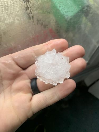
Viewers across central Illinois also submitted pictures and video of hail to WAND News. Some areas saw hail quarter-sized to golf ball sized.
Heavy rains also canceled the highly anticipated season opening race at Charleston Speedway, according to the speedway's Facebook page.
The spring season has been ripe with severe weather already. WAND Chief Meteorologist Jim Kosek reported Illinois has already seen about half its normal total for an entire year through just the first three months of 2025. The National Weather Service reported Illinois saw 142 tornadoes in 2024. The number bested the previous record high of 125 that was set in 2006.
Stay safe and up-to-date with the WAND Weather App. Click here to download.
Copyright 2025. WANDTV. All Rights Reserved.