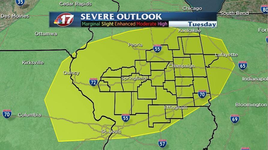

(WAND) - The severe weather threat across Central Illinois is increasing for Tuesday afternoon and evening.
The Storm Prediction Center now has the area under a "Slight" risk, which is level two out of five.

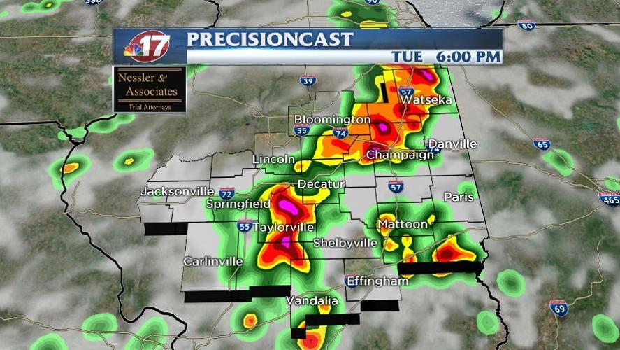
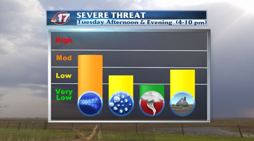
Strong to severe storms will likely move into our western hometowns around 4 p.m. and exit the area by 10 p.m. Tuesday.
The biggest threats from these storms will be damaging winds and flash flooding.
Large hail is a secondary threat and an isolated tornado can't be ruled out.
The StormCenter 17 Weather Team is monitoring the severe weather threat and will have all the watches and warnings on air and on social media.


