


DECATUR, Ill. (WAND) - A strong storm system continues to deepen in the central plains, producing gusty winds and blizzard conditions.
The mid-latitude cyclone will slide northeast overnight, continuing to tighten up the pressure gradient and producing strong gusty winds in central Illinois.
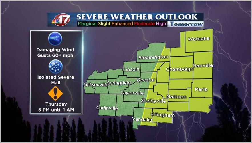
WAND-TV Chief Meteorologist JC Fultz says there are two parts to this system he is keeping an eye on. Strong and gusty gradient winds are expected Thursday and Friday, plus a chance for some strong to possibly severe storms Thursday late afternoon/evening.
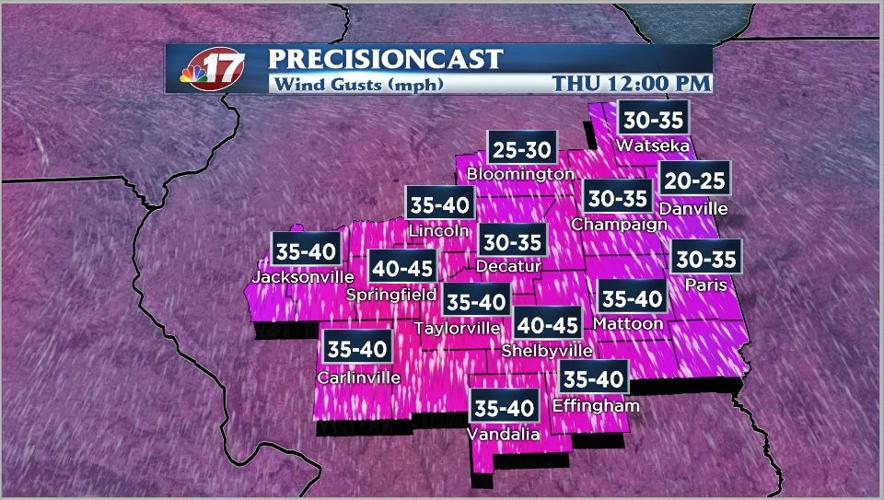
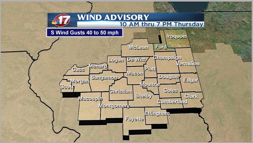
Strong southerly winds will increase overnight and continue through much of Thursday. Look for sustained southerly winds of 20 to 30 mph with gusts of 40 to 45 mph. A wind advisory has been issued for central Illinois from 10 a.m. until 7 p.m. Thursday.
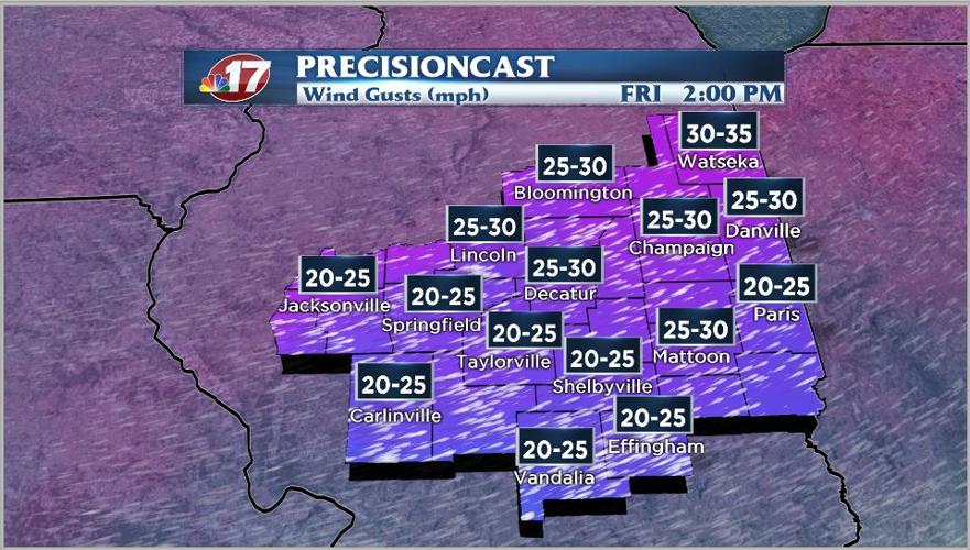
Fultz says gusty winds will continue Friday, but won’t be as strong. Look for gusts of 30 to 35 mph for most of the day Friday.
Storms are expected to develop Thursday late afternoon and sweep across the area Thursday evening. Fultz says a few storms could be strong to severe with the main threat being damaging winds and an isolated large hail report. A 2-Slight Risk (Yellow) is in place from US-51 east with the rest of the CI in the 1-Marginal Risk (Green). Look for the greatest risk for severe weather to be between 5 p.m. Thursday and 1 a.m. Friday.
Make sure to follow the WAND-TV team of meteorologist on Facebook and Twitter, along with updates here at wandtv.com.