DECATUR, Ill. (WAND) - Showers and storms are back in the forecast for Wednesday night, with a few storms becoming strong to possibly severe.
Chief Meteorologist JC Fultz says storms will develop across Missouri this evening and slide through central Illinois tonight into Thursday morning. Forecast models are showing the greatest risk associated with this line of storms being strong gusty winds, but some hail and locally heavy rains are also possible. Fultz says scattered showers are possible through Thursday into Thursday night.
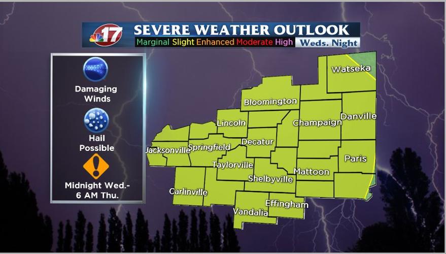
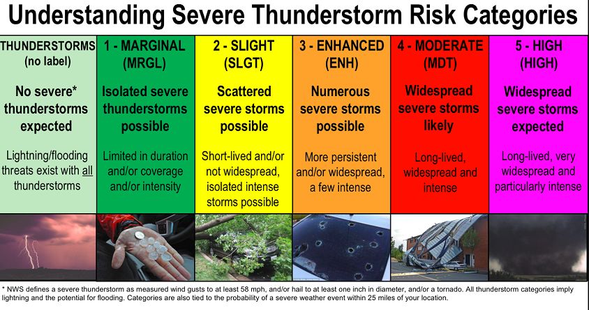
The Storm Prediction Center has a 2-Slight Risk in place for all of central Illinois
Main Threats: Damaging Winds, Iso. hail possible
Timing: Midnight Wednesday night through 7 a.m. Thursday
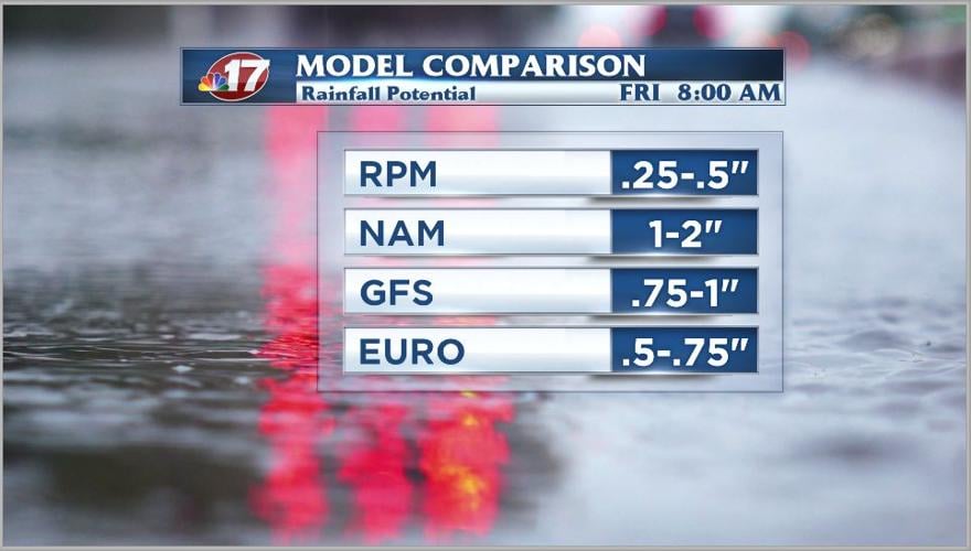
The WAND-TV team of meteorologists will be closely monitoring the development of storms Wednesday evening and throughout the night. Rainfall amounts from Wednesday through Friday morning look to be near 1 inch in most of the central Illinois area, with locally heavier amounts possible where stronger storms develop.
Make sure to remain weather aware Wednesday night through Thursday. Before going to bed, viewers should make sure their NOAA Weather Radio is turned on and working. A NOAA Weather Radio is an indoor warning siren and will let a person know severe weather is headed their way.


