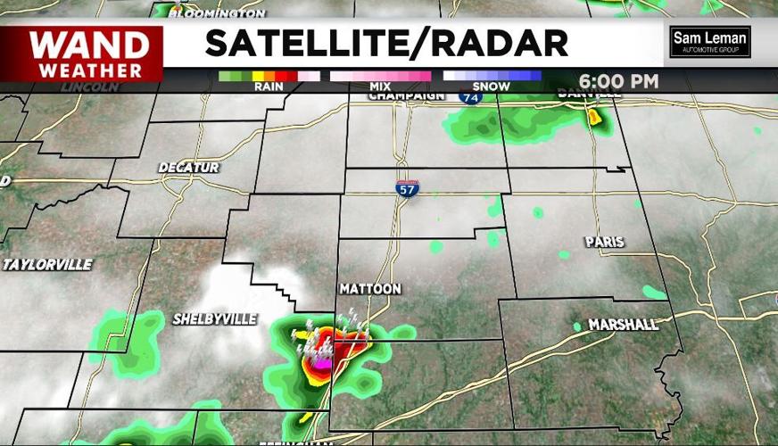

TROWBRIDGE, Ill. (WAND) - A possible microburst was reported in Shelby County on the southwest side of Trowbridge.
Several large trees were uprooted, livestock fencing was knocked down due to winds estimating at 80mph. Why does this happen, you may wonder?
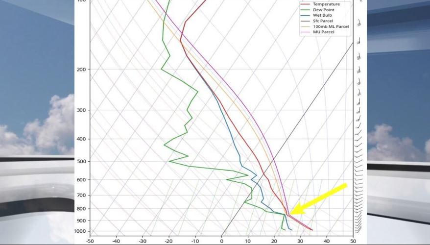
Let's first take a look at today's weather sounding. Soundings are vertical profiles of the atmosphere, giving us a glimpse at several weather variables at varying heights. If you've ever heard of a weather balloon, that's what carries the instrumentation to capture these vertical profiles.
Take note of the graphic attached. You don't need a rocket science degree. Simply put, temperature increases from left to right, and height increases from bottom to top. The red line is temperature; green is dew point temperature and blue is the wet bulb temperature.
For our purpose today, forget the blue wet bulb temp line. The yellow arrow denotes where the air temp and dew point temp are close to each other. However, below that elevation, you will see how the red and green line form an inverted "V". These inverted V soundings show dry air close to the ground. Therein lies today's problem.
As rain falls from a thunderstorm, it evaporates.
Evaporation is a cooling process (you feel it when you hop out of the pool- you feel chilly as the water is evaporating on your skin). Well, cool air is more dense than warm air, and it sinks. The dry air close to the ground on the sounding enhances the evaporation rate, allowing the air to descend rapidly from a thunderstorm.

Unfortunately, this is exactly what took place earlier today in Shelby county (radar included). The damaging microburst wind from a thunderstorm was enhanced by the drier air shown on the inverted V sounding.
Always stay safe and weather aware.
Copyright 2025. WANDTV. All Rights Reserved.


