


DECATUR, Ill. (WAND) - Happy Monday! The kids are heading back to school this week, and the forecast returns to a wetter pattern as well. A slow-moving cold front inches closer to Central Illinois, bringing more rain chances for the start of the work week.
It will be another warm day in the upper 80s this afternoon. We started the day with a mix of spotty showers and partly cloudy skies. Those isolated showers will continue to pass through into the afternoon, otherwise, we can expect sunshine to persist.
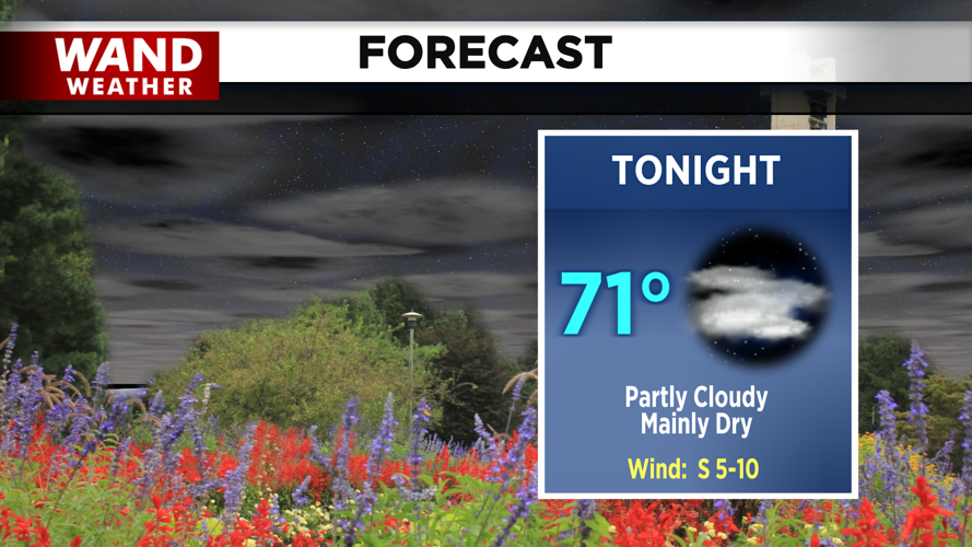
Tonight, a few clouds remain, and showers may linger for our most northwestern hometowns. Temperatures dip into the low 70s.

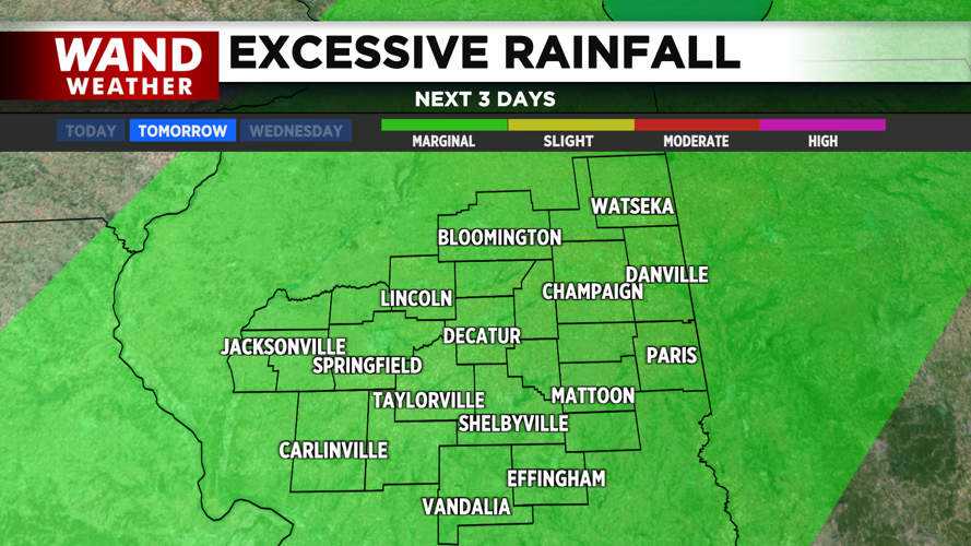
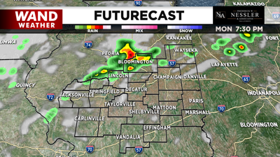
A better chance for widely scattered showers and storms moves in tomorrow as the cold front continues its trek through Central Illinois. This may bring a few heavy downpours at times, leading to ponding in areas with poor drainage. However, thunderstorms are not expected to be severe at this time.

If you have been tracking the Tropics this hurricane season, you may have noticed an overall slow start. Mid-August marks the beginning of what NOAA considers "peak season" when tropical activity typically begins to pick up (if it hasn't already). Earlier today, Tropical Storm Erin was named, and is currently the first storm of the season forecasted to intensify into a major hurricane (category 3 or higher). This most likely wouldn't happen until over 2 to 3 days from now, which means we'll need to monitor this storm closely as it approaches several countries across the Carribean.

Copyright 2025. WANDTV. All Rights Reserved


