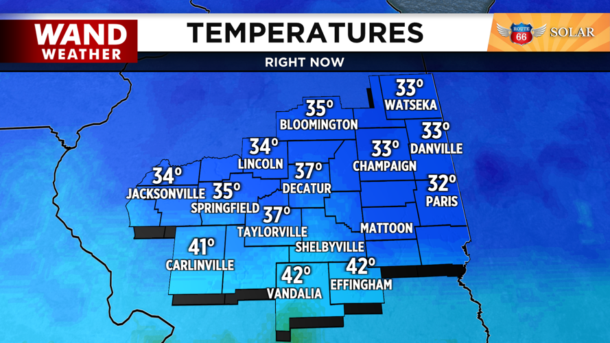
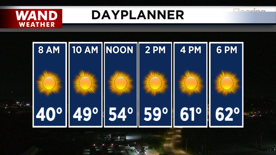


DECATUR, IL. (WAND) - Happy Monday! Temperatures have dropped overnight into the low 30s across Central Illinois. Frost advisories and freeze warnings are in place for early Monday morning. Sunny skies with calm winds out of the south will help warm up the region. It will be seasonable today with high temperatures hitting the low 60s by the late afternoon.
It will be much warmer for the rest of the week. Temperatures will drop into the 40s overnight, so the frost and freeze threat won’t make a return. Temperatures will soar tomorrow with breezy conditions out of the south. Expect highs to be in the upper 70s and low 80s through Thursday.
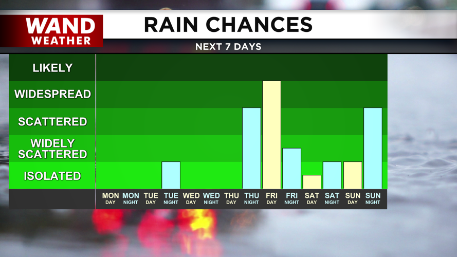
There is a slight chance of overnight showers on Tuesday night, but these look very scattered. Most of the area won’t see much, if any, accumulation. Thursday night is looking much more active. Strong storms will move in on Thursday evening and linger through Friday. The severe weather threat looks low at this time, but we will monitor these storms closely as we progress through the week.
Temperatures will plunge behind the storms. Highs will be close to average this weekend in the low 70s. Overnight lows will be cool in the upper 40s, but there shouldn’t be any threat of frost through the weekend.
Copyright 2026. WANDTV. All Rights Reserved.


