

DECATUR, IL. (WAND) - An extremely unsettled week is ahead for Central Illinois, with multiple rounds of severe storms and dangerous heat that will affect your commute, outdoor plans, and daily activities through Friday.
Monday: Dangerously Hot With Storm Threat
Scattered storms could begin as early as 10 a.m. Monday, though recent forecast models suggest the morning storms may be less intense than previously expected. However, additional storms will be possible through the afternoon and evening hours.
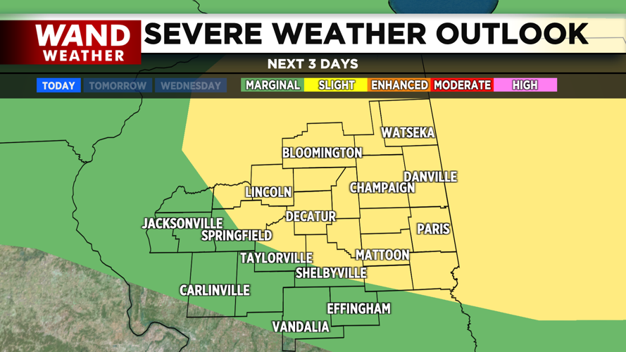
The Storm Prediction Center has placed the northeastern counties under a slight risk for severe storms, while southern counties are under a marginal risk. The northern counties face the highest threat for severe weather.
If storms develop, all modes of severe weather are possible, including damaging wind, large hail and isolated tornadoes. Wind and hail will be the primary threats.
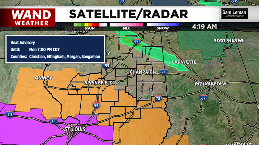
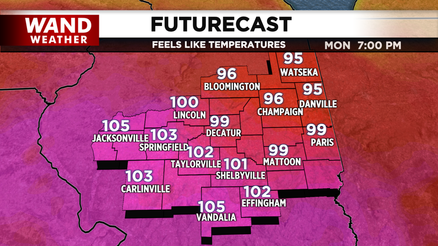
The bigger concern for most of Central Illinois on Monday is the dangerous heat. High temperatures will reach the low 90s, but the combination of heat and humidity will make it feel like 100 to 105 degrees across the entire region. The southern counties are under a Heat Advisory until 7 p.m.
Overnight Monday into Tuesday, temperatures will only drop into the mid-70s with partly cloudy skies. Storms remain possible during the early morning hours, mainly in the northern counties.
Tuesday: Another Hot Day, Evening Storm Threat
Tuesday will bring another very hot and muggy day with feels-like temperatures again reaching close to triple digits.
Another round of strong to severe storms will be possible Tuesday evening. The severe weather outlook is similar to Monday's — a slight risk for the northeastern counties and a marginal risk for the southern counties. Wind and hail will again be the main threats, with isolated tornadoes possible.
Wednesday Through Friday: Widespread Rain, Cooler Trend
Wednesday will feature widespread showers and storms across Central Illinois. A marginal risk for severe storms exists for all of the region. High temperatures will be slightly cooler, pushing into the mid to upper 80s as rain and storms move through.
Thursday will bring the most widespread rain and storm activity of the week. While some storms could be strong, the overall severe weather risk looks lower as cooler air moves in with high temperatures only in the low 80s.
Similar conditions are expected to continue into Friday.
Stay Prepared
This week requires your attention. Keep multiple ways to receive weather alerts — download the First Alert Weather app, enable push notifications, and have a NOAA Weather Radio on hand. Know where you'll take shelter if severe storms develop, and have a plan for staying cool during the dangerous heat.
Copyright 2026. WANDTV. All Rights Reserved.


