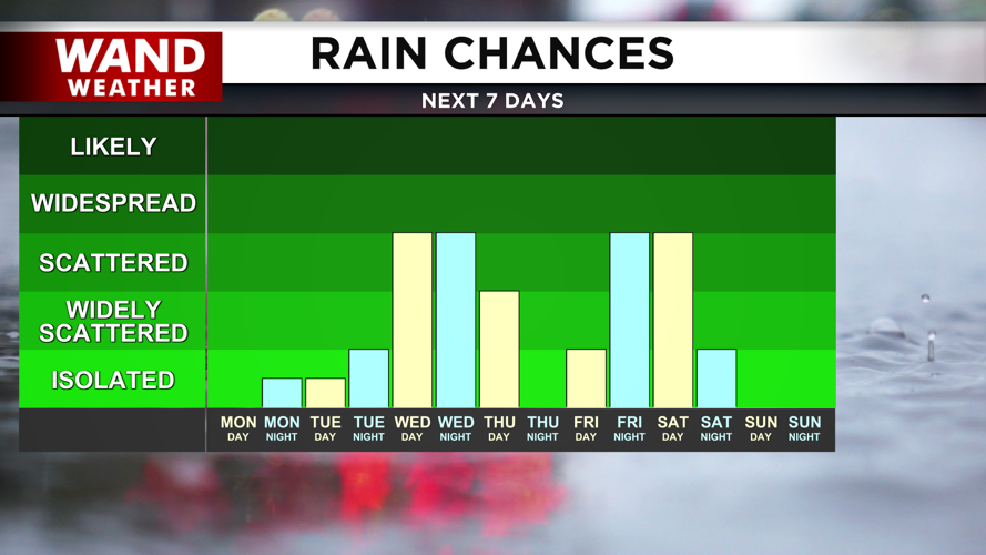


DECATUR, IL. (WAND) - Happy Monday! It is a warm and windy start to the week, with showers and storm chances expected most of the week. Temperatures this morning are already in the 60s. This is closer to where our average high temperatures should be. Temperatures will soar into the low 80s by the afternoon with the gusty winds out of the southwest. An isolated storm is possible for areas north of I-74, but most of the rain today will stay out of the area.
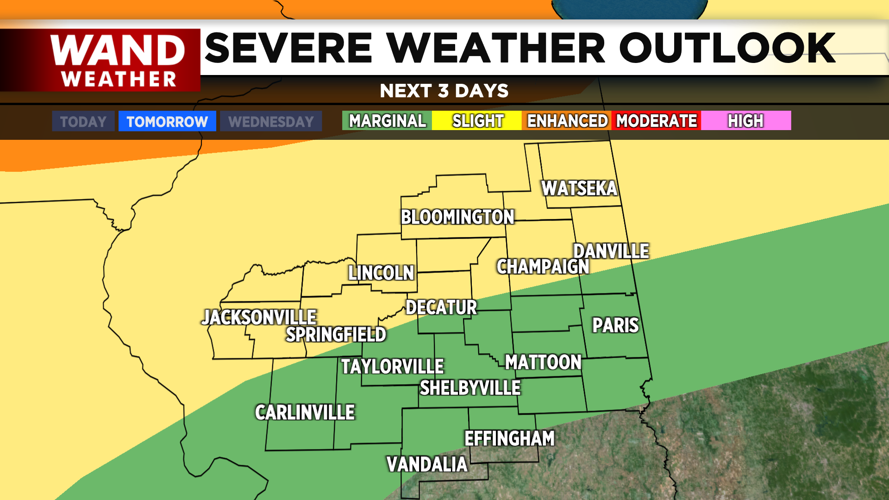
Storm chances will kick off on Tuesday afternoon. The chances for severe weather will ramp up on Tuesday afternoon, and we will see daily chances for storms through Friday afternoon. The timing of the storms is still a bit uncertain. The front will be further north, so areas in Northern Illinois will see a better chance for widespread storms.
Some models are showing scattered storms as early as Tuesday afternoon. These will be strong if they do develop, and could reach severe limits with strong winds and hail being the big concern. Some models are pushing the storms until later in the evening. These could linger into early Wednesday morning.
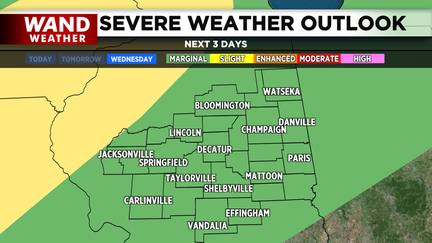
There are two scenarios that are possible for the severe weather on Wednesday. If storms linger through Wednesday morning, that would erode the severe weather risk for the afternoon. However, if we wake up on Wednesday and it is mostly clear, then the severe weather risk will return for the afternoon. We will watch the development closely to see what we should watch out for on Wednesday.
Rain chances will linger through Thursday morning before we dry out for the afternoon. Friday is looking mostly sunny and dry, but it won’t last long. Rain and some storm chances move in Friday night and will linger through Saturday as a cold front moves through. This will finally bring in cooler weather for next week.
Copyright 2026. WANDTV. All Rights Reserved.


