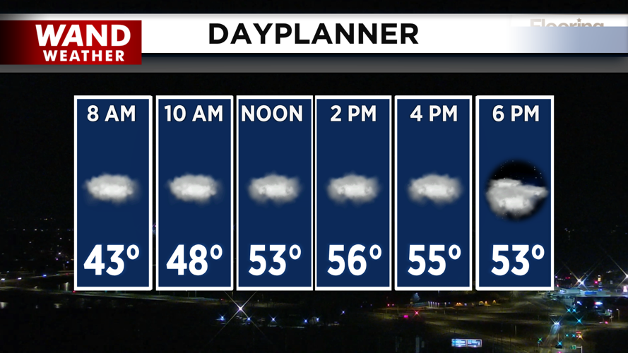

DECATUR, IL. (WAND) - Happy Tuesday! It was a gorgeous start to the week with temperatures in the 60s and sunny skies. The clouds will take back over today as winds pick up out of the south. This will keep temperatures mild in the upper 50s for the afternoon. There is a chance of a few isolated to scattered showers through the evening, but very little accumulation is expected at this time.

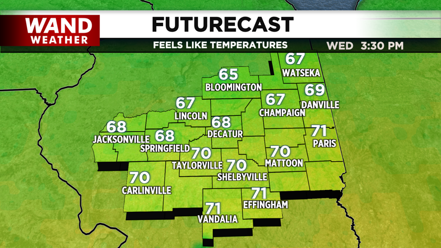
Temperatures tonight will stay warm in the 50s, and Wednesday will be the warmest day of the year so far. High temperatures will challenge records with highs in the upper 60s and mostly sunny skies.

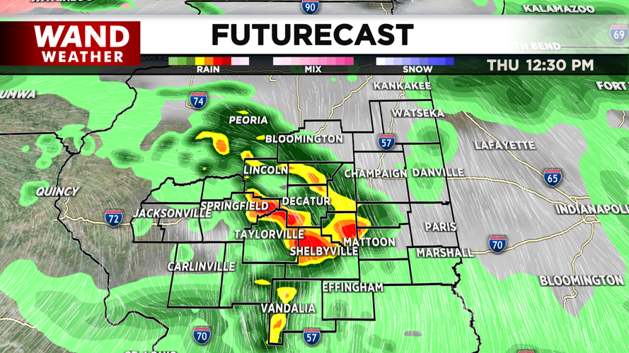
Our next weather maker will move in on Thursday as a low-pressure system moves across the Midwest. This will drag a cold front across Illinois and trigger showers and thunderstorms. Storms are expected to be strong to severe with a slight risk (level 2) for storms to reach severe weather limits across much of Central Illinois. Winds, hail, and isolated tornadoes are all possible with this system.

Stay tuned for updates, and download the WAND Weather app for the latest.
Copyright 2026. WANDTV. All Rights Reserved.


