
DECATUR, IL. (WAND) - Happy Tuesday! It will be another breezy day, but a much warmer one overall. Winds will be gusting out of the southwest through the afternoon. This will drive in warmer air across much of the Midwest. Temperatures will top off in the mid-40s this afternoon despite the clouds.
Temperatures will be much warmer overnight into Wednesday morning with lows in the upper 20s. Wednesday looks mild as mostly sunny skies return. High temperatures will once again warm up into the 40s before our next weather maker moves into Illinois.
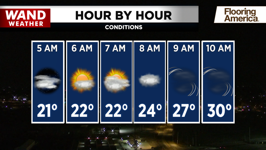
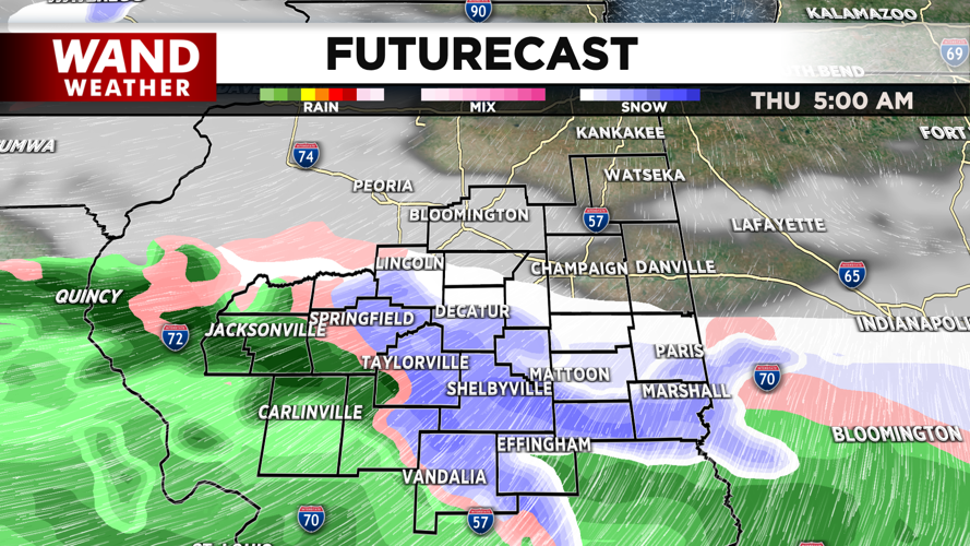
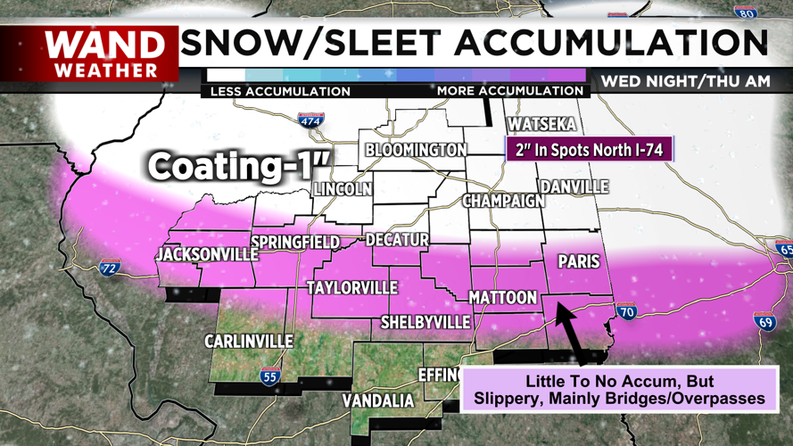
A system will impact Illinois overnight Wednesday and linger through Thursday morning. The bulk of the precipitation will start as rain and transition to a snow or sleet mix for areas along the I-72. The exact location of the freezing line will make a massive difference in this system. If the line moves south of I-72, we can expect to have slippery travel conditions for the Thursday morning drive. Areas north of I-74 will have the best chance for snow.
The snow chances won’t hang around for very long. Temperatures will warm up well above freezing through the morning and afternoon on Thursday. Friday and Saturday are looking great with sunny skies and above-average temperatures in the mid-50s.
Copyright 2026. WANDTV. All Rights Reserved.


