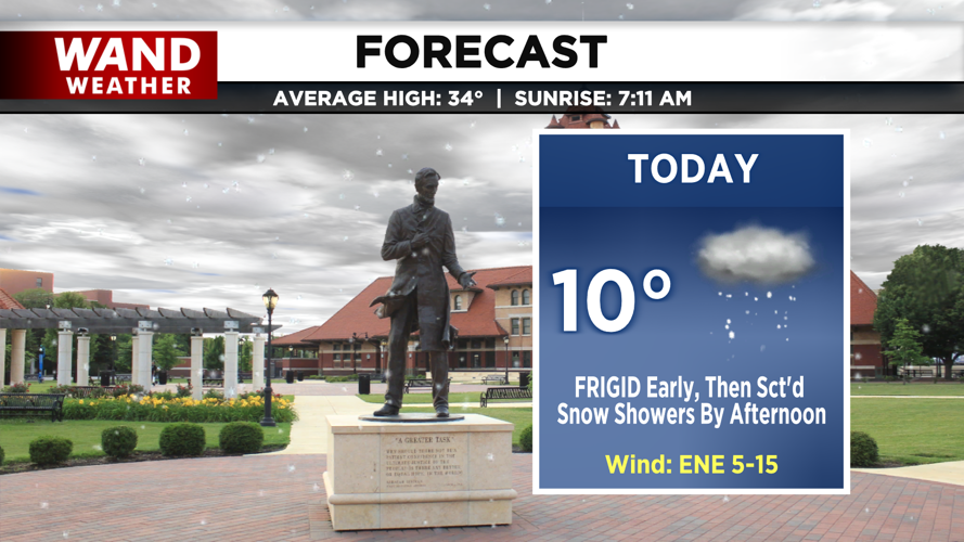

DECATUR, IL. (WAND) - A winter storm begins to roll in this afternoon. This storm brings major impacts across the U.S., including here in central Illinois.

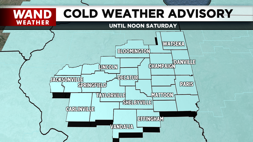
Today, we start the day quietly with frigid temperatures in the negatives that feel like negative teens and 20s. Our Cold Weather Advisory will remain in effect through midday. Highs today will top off in the upper single digits and low teens.

By this afternoon, scattered snow showers will roll in. They’ll be on and off throughout the evening, but after a lull in activity late this evening, a second round of widespread, steady snowfall will arrive overnight. This will continue into the early afternoon on Sunday.

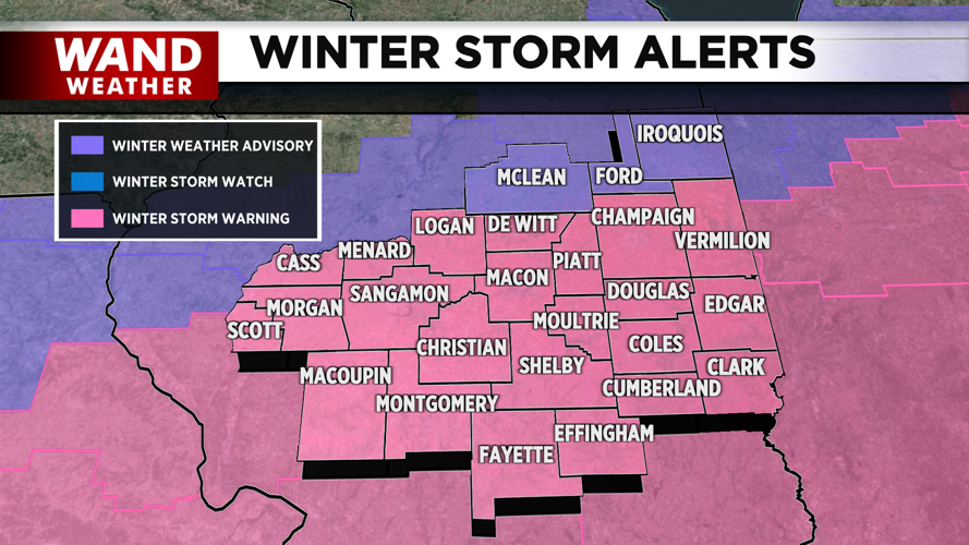
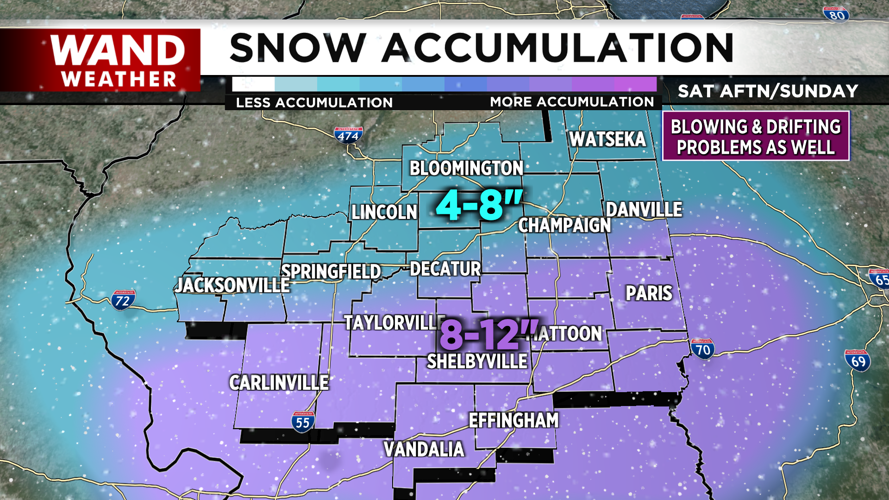
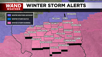
Between today and tomorrow, we can expect anywhere from 8 to 12 inches of snowfall for areas along the I-70 corridor and south. Along and north of I-72 will see 4-8 inches, with the lowest totals farther north. A Winter Storm Warning is in place for the majority of central Illinois, and a Winter Weather Advisory has been issued for our northeastern counties.
Behind it, another round of frigid air in the negatives returns as we head into the start of the workweek, and several mornings with wind chills in the negatives will be in store.
Copyright 2026. WANDTV. All Rights Reserved.


