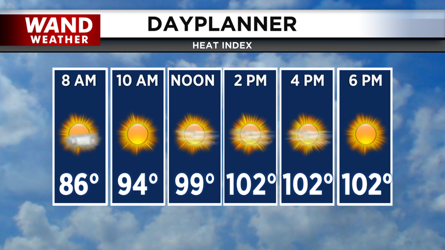
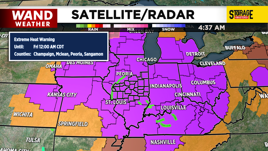


DECATUR, IL. (WAND) - Happy Tuesday! The National Weather Service has upgraded our heat advisory to an extreme heat warning for the entire state of Illinois. This indicates that the heat index will be between 105 and 110 by the afternoon. This extreme heat warning will be in place until Thursday night at midnight, so don’t expect much relief for the next few days.
Temperatures through Thursday will be in the mid-90s with plenty of sunshine. The humidity will make it feel much warmer. Overnight lows will stay in the mid to upper 70s. Strong winds out of the south will pump in moisture off the Gulf through Friday. This will lead to an unsettled weather pattern for the back half of the week.
Storm chances will return on Friday and linger through the weekend. Friday’s storm chances look isolated, but more widespread showers could move in by Saturday afternoon. Severe weather isn’t expected at this time, but storms could produce heavy rainfall that could cause flash flooding. Seasonable temperatures in the 80s should return for next week.
Copyright 2026. WANDTV. All Rights Reserved.


