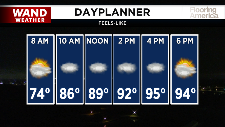


DECATUR, IL. (WAND) - Another round of storms will threaten Central Illinois Thursday, with strong winds posing the greatest threat as temperatures climb into the upper 80s and heat index values soar above 100 degrees in southern counties.
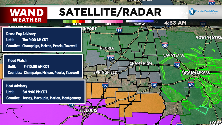
A dense fog advisory remains in effect for counties north of the I-72 corridor until 9 a.m., reducing visibility for the morning commute. Temperatures started cool this morning in the upper 60s to low 70s but will warm quickly throughout the day.
Storm Timing and Threat
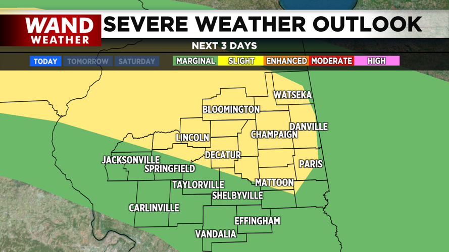
The main weather concern arrives in the early afternoon, similar to Wednesday's pattern. A slight risk for severe storms is in place for the northern half of Central Illinois, including Decatur, Champaign, Lincoln, and Mattoon. Springfield sits right on the edge of this risk zone, while the remainder of the area faces a marginal risk.
Strong winds will be the primary threat as storms develop and move across the region. However, all modes of severe weather remain possible, including hail and heavy rainfall. Storms are expected to be smaller overall and may struggle to maintain strength as they cross the Illinois River.
Heat Advisory for Southern Counties
A heat advisory is in effect for southern counties Thursday, where the combination of heat and humidity will push feels-like temperatures above the 100-degree mark. Take precautions if you'll be spending time outdoors, and check on vulnerable family members and neighbors.
Evening and Friday Morning Storms
Another round of showers and storms could develop late Thursday night into early Friday morning. These will be hit-or-miss, but some could strengthen during the morning commute. Stay weather aware if you're traveling before sunrise Friday.
Weekend Outlook
Friday afternoon will see highs in the upper 80s with heat index values near the upper 90s. The weekend will be even hotter, with highs climbing into the low 90s on Saturday and Sunday. Conditions should remain mainly dry through Sunday, with rain holding off until Sunday night when a cold front approaches.
That cold front will bring a chance for storms Sunday night, but it will also usher in cooler and drier conditions for next week — a welcome relief from the heat.
Copyright 2026. WANDTV. All Rights Reserved.