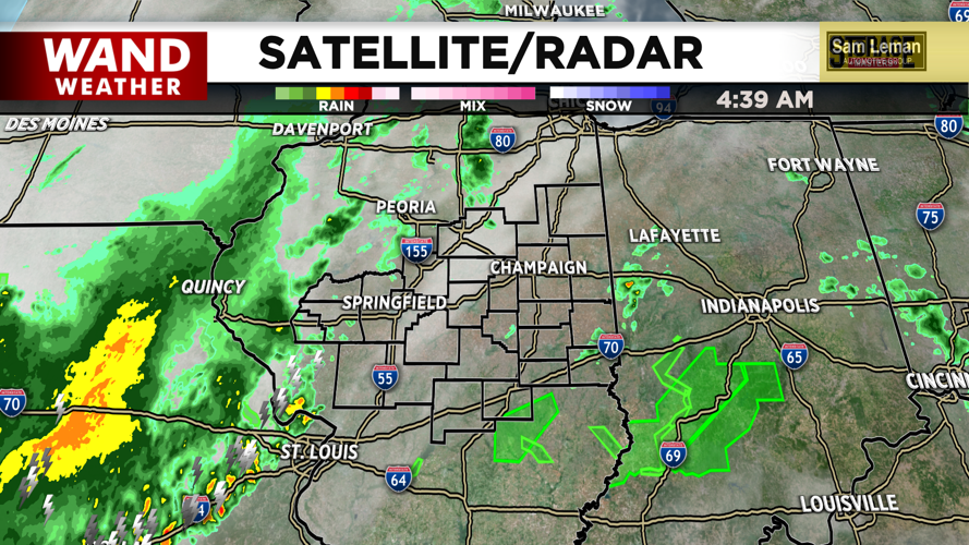
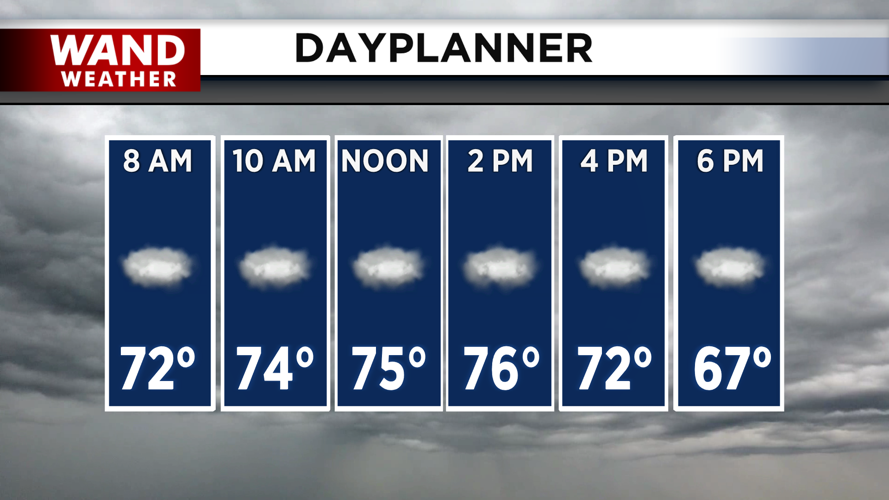
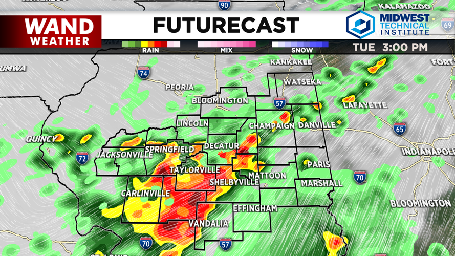


DECATUR, IL. (WAND) - Another round of storms is expected throughout the day as a cold front starts to push in from the north. Scattered showers with a few storms will hang around through the morning, but we should see a lull in the rain chances by late morning. Another round of storms is possible for the afternoon.
There is some disagreement in the weather models for today's storms. Some models are showing strong storms developing south of I-72 around 1 or 2 pm, while other models are showing just some scattered showers. We will err on the side of caution and prepare for at least some scattered strong storms to be in the area through the early evening. Winds will be the biggest threat again with these storms. The severe threat will clear out this evening as the cold front itself slides south of the area.
Much cooler and calmer conditions will move in for the back half of the week. Temperatures will go from the upper 70s and low 80s today to highs in the upper 60s through Friday. Rain chances will return on Friday. These will be mostly just steady showers, but there will be a few scattered storms as well. Dry and warmer conditions will return for the weekend.
Copyright 2026. WANDTV. All Rights Reserved.


