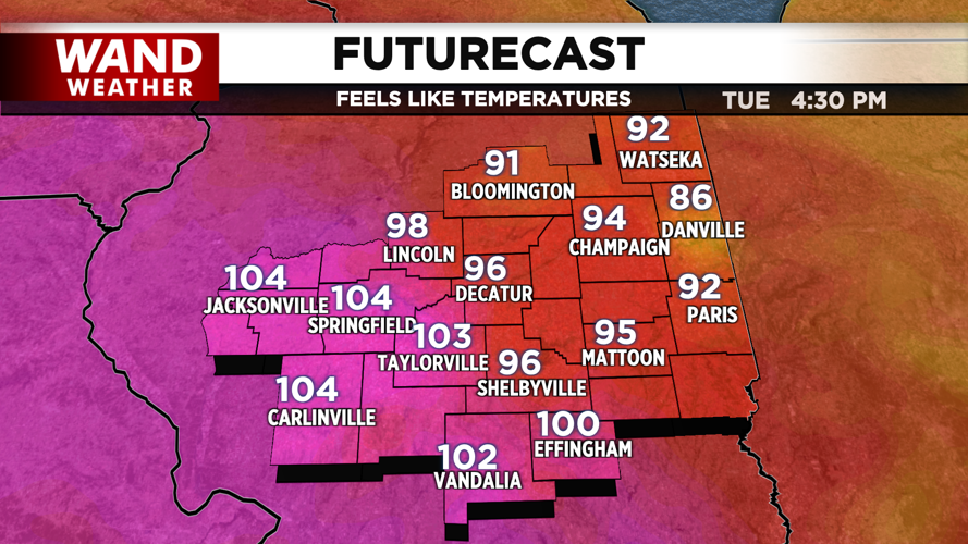


DECATUR, IL. (WAND) - A hot and potentially active stretch ahead with strong winds and heavy rain expected today and Wednesday
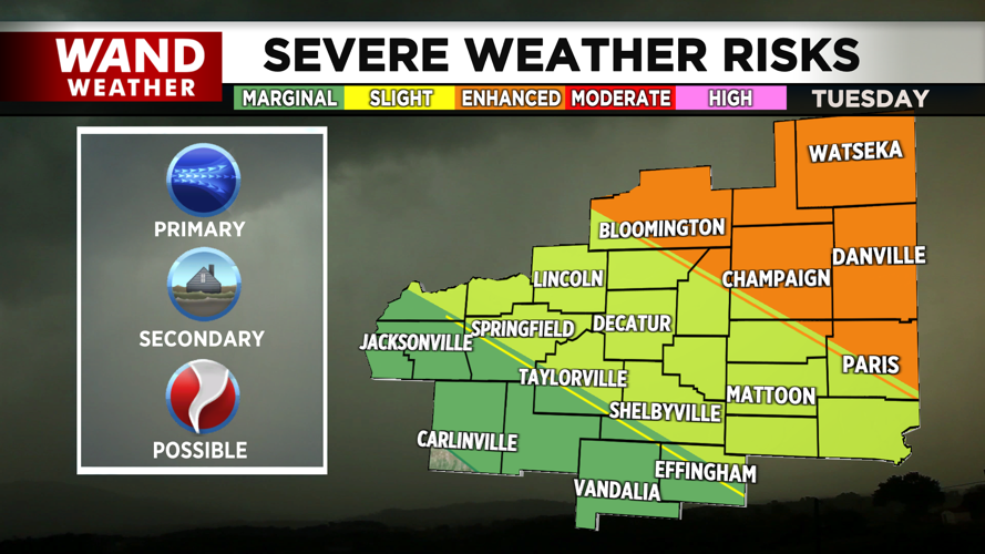
Central Illinois is bracing for a dangerous combination of extreme heat and severe weather over the next several days. An enhanced risk for severe storms is in place for Tuesday afternoon, with the primary threat focused along and north of I-74.
Today: Heat Advisory + Strong Storm Threat
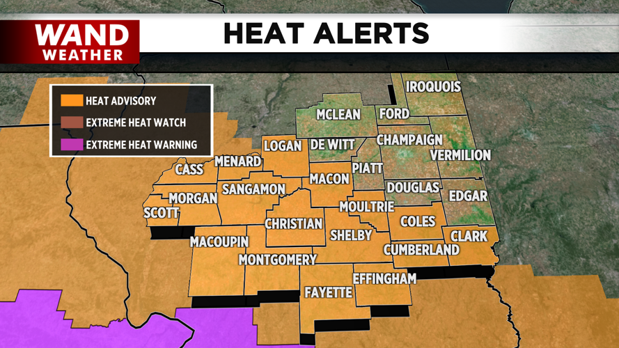
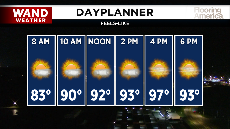
A heat advisory is in effect for most of Central Illinois as feels-like temperatures will soar above 100 degrees this afternoon. But the heat is only half the story.
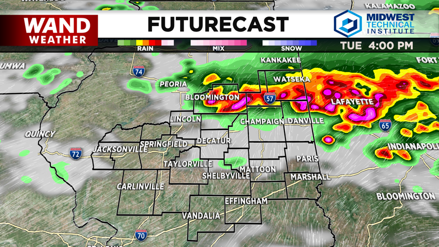
The weather team is closely monitoring an outflow boundary expected to move through the region around 3 p.m. This boundary could trigger very strong winds—potentially gusting as high as 70 mph—along with heavy rain. The Storm Prediction Center has placed an enhanced risk for severe storms in place for the I-74 corridor and areas to the north.
The good news: most thunderstorms should clear out by 7 p.m., giving you the evening to recover and prepare for what comes next.
Wednesday: More Heat, More Storms
Wednesday won't bring much relief. Temperatures will again warm quickly, with feels-like temperatures pushing into the upper 90s and low 100s by afternoon.
Another round of strong storms is expected to move through Central Illinois Wednesday afternoon. A slight risk for severe storms is in place, with strong winds and heavy rain as the primary concerns. This will be a similar setup to Tuesday, so stay weather-aware throughout the day.
Thursday: The Heat Breaks
By Thursday evening, a cold front will push through Central Illinois, finally flushing away the oppressive heat and humidity. A marginal risk for severe storms is in place as this front moves south, with strong storms possible, but the main story is the arrival of much more comfortable air.
Friday will bring a welcome break with afternoon highs dropping into the lower 80s and mostly sunny skies.
Weekend: Heat Returns
Don't get too comfortable. Temperatures will bounce back for the weekend, with highs in the upper 80s and feels-like temperatures in the upper 90s returning.
Copyright 2026. WANDTV. All Rights Reserved.


