

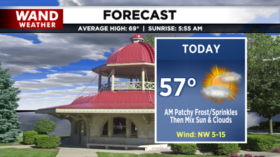
DECATUR, IL. (WAND) - Happy Saturday! The weekend is starting off on a chilly note. Temperatures this morning in the upper 30s may allow for patchy frost for some north of I-74, but most are a bit too warm or cloudy. A few areas farther south even have a few light sprinkles rolling through this morning.
The better portion of our day will be mostly dry and partly cloudy. Temperatures remain cool with highs in the upper 50s.

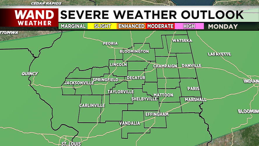
Tonight, skies clear back out and temperatures may return to the upper 30s for a few, but clouds returning by mid-morning tomorrow will reduce the frost concerns for most. Those clouds are ahead of chances for showers between Sunday and Monday. By Monday night, we may even be tracking a few severe thunderstorms as well. The main concern will be wind and hail.
Stay weather aware!
Copyright 2026. WANDTV. All Rights Reserved.


