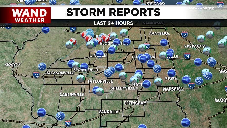


(WAND) - Quieter weather is expected across central Illinois after our second round of severe storms in less than a week.
While it's now officially spring, severe thunderstorms with damaging winds and possible tornadoes moved through the area Wednesday afternoon and evening.
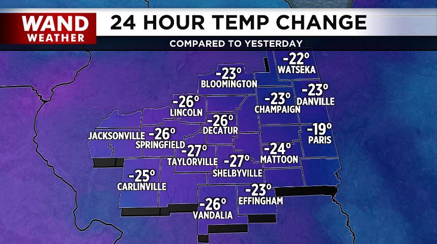
Much colder air blew in behind the storms last evening and rain showers changed over to snow showers.
Those will depart this morning with sunshine returning today with highs only in the 40s. We'll drop into the frosty 20s tonight.
It'll be windy and warmer Friday with highs in the low-60s.
Another round of showers is possible Friday night.
As for the weekend, Saturday will be sunny with highs in the 50s. A heavier round of rain returns Saturday night into Sunday with some storms possible.
Meteorologist Anthony Peoples
Copyright 2025 WAND TV. All rights reserved.


