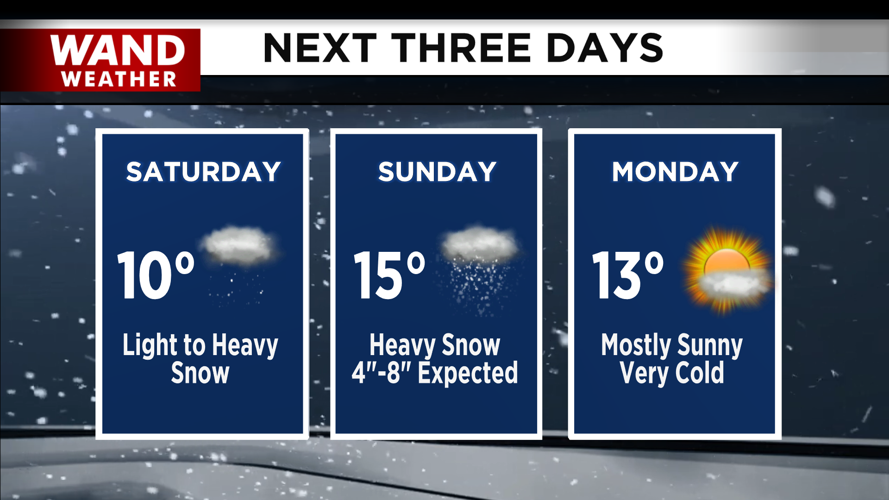
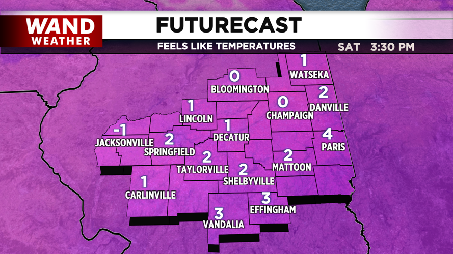
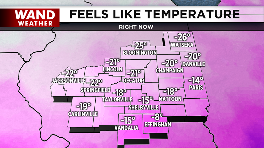


DECATUR, IL. (WAND) - The dangerous cold has settled into the Midwest, and windchills are well into the negative teens. Afternoon highs will only climb a few degrees today into the low single digits. Wind chills and actual temperatures will stay well below 0 tonight. Winds will die off, and we should climb back above 0 by Saturday afternoon.

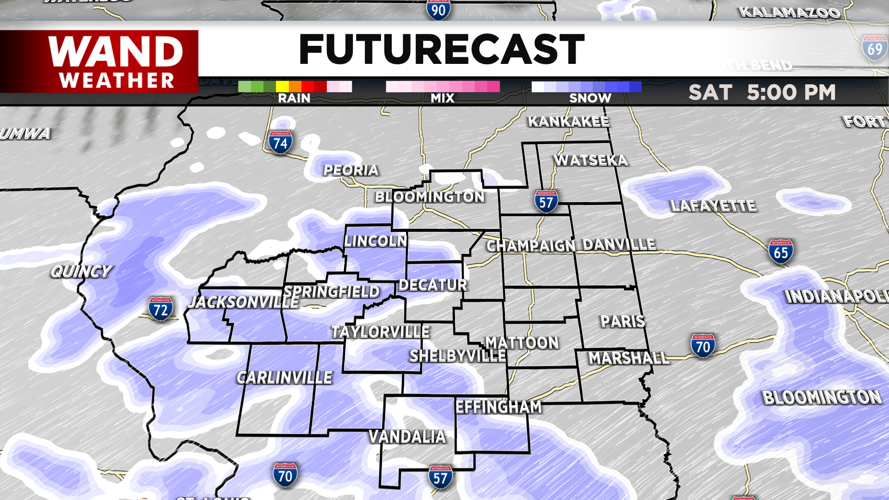
The models continue to show a significant snow event for Central Illinois this weekend. Light snow will begin to fall around the area on Saturday afternoon. This will last through the early evening, but it won’t be steady the entire day. This should lead to minor accumulation of around an inch.

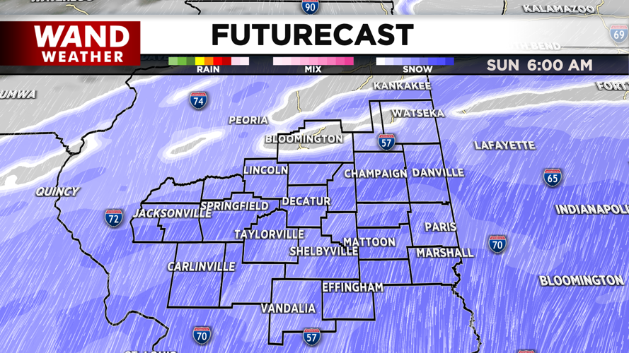
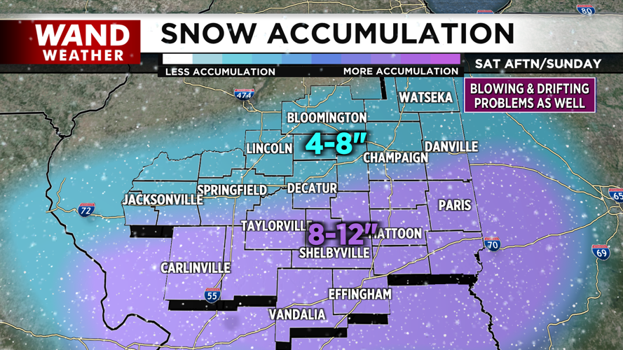
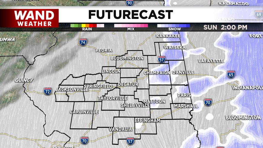
There will be a break in the snow on Saturday evening, but another round of snow will be much more impactful on Sunday. The 2nd round will begin just after midnight Sunday morning, and this will last through the early afternoon. The snow amounts on Sunday will be much higher. Areas south of I-70 could see 10+ inches of snow. Areas between I-70 and I-72 are in line for 6-10 inches of snow. Areas north of I-72 will see closer to 4-8 inches of snow.


The snowstorm should exit by Sunday evening. While there won’t be additional snowfall overnight into early Monday, you should expect travel to be very difficult on Monday morning as crews work to clear snow from the weekend. Temperatures will stay well below average through next week, so stay warm and safe.

Copyright 2026. WANDTV. All Rights Reserved.


