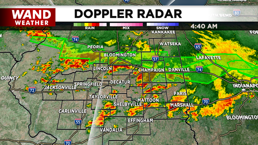


DECATUR, IL. (WAND) - Strong storms rolled through Central Illinois overnight, leaving behind heavy rain and dangerous road conditions as the region heads into Friday morning.
The severe weather threat has diminished for now, but heavy rain continues to move through the area, creating hazardous conditions for the morning commute. Flash flood warnings remain in effect for Champaign, McLean, and Vermilion counties until 6:45 a.m.
Street flooding has already been reported in Champaign, with some roads becoming impassible. High water issues are affecting areas along the I-74 corridor. Drivers should avoid flooded roadways and allow extra time for their commute.
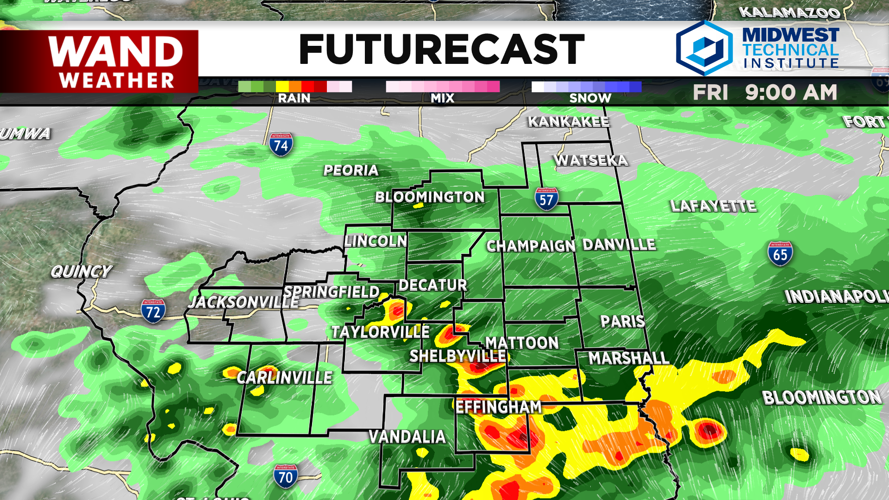
Rain and storms will continue impacting the area through the morning before gradually exiting by afternoon.
Afternoon Heat and Humidity Build
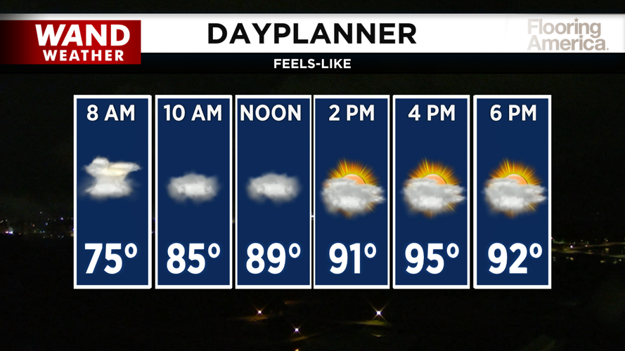
Friday afternoon will bring relief from the rain, but intense heat and humidity will take over. Expect a mix of sun and clouds with feels-like temperatures climbing near 100 degrees.
A heat advisory is in effect for all counties south of I-72. Even with actual highs in the upper 80s to low 90s, the combination of heat and humidity will make it feel significantly hotter.
Overnight Friday into early Saturday, temperatures will remain hot, with lows only dropping into the low to mid-70s. Another round of storms could develop overnight into early Saturday morning, potentially producing strong to dangerous wind gusts and heavy rain.
Saturday: More Heat, More Storms
Saturday brings a marginal risk of severe storms for the entire area. Showers are expected to die off early in the morning, leaving another hot and muggy afternoon ahead.
Feels-like temperatures will again push into the triple digits, with actual highs in the low 90s.
Brief Break Before Next System
Sunday will start dry with a mix of sun and clouds, but the heat and humidity will remain relentless. Temperatures will push into the 90s with feels-like temperatures similar to Saturday.
A cold front will move through overnight Sunday into early Monday morning, finally breaking the oppressive heat and humidity that has gripped the region.
Relief Coming
Monday and Tuesday will bring much cooler conditions, with highs in the low 80s and noticeably lower humidity levels. No rain is expected until Wednesday evening.
Copyright 2026. WANDTV. All Rights Reserved.


