
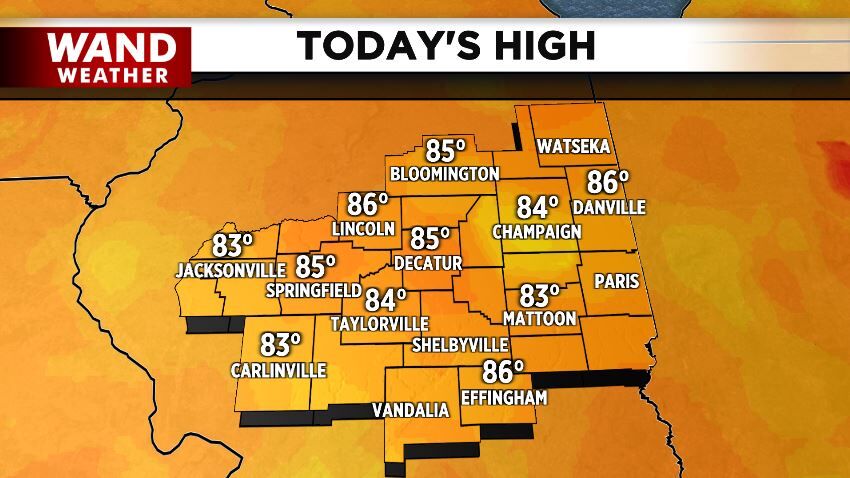
Temperatures got closer to "normal" Monday with high temps rising into the middle 80s across central Illinois. Technically the "normal" high temperature for this day is 87º, which will be our high temperature tomorrow.
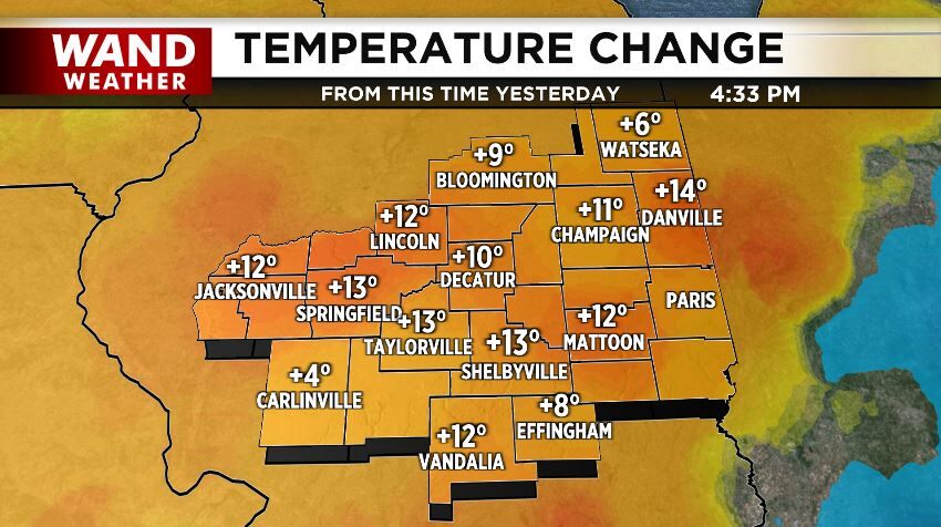
Highs in the middle 80s Monday meant during the hottest part of the day, the temperature rose about ten degrees since the same time Sunday. Rising temperatures will be a theme this week as high temps keep climbing until a cold front rolls through Thursday.
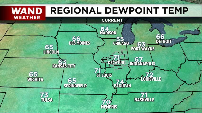
When you combine that heat with dewpoints in the 70s, the air feels uncomfortable. Again, looking at the hottest part of Monday, the air felt like the low 90s in most spots. That humidity will also stay with us until the Thursday cold front arrives.
When heat and humidity combine, they lead to something called instability which means the air can rise and generate showers and thunderstorms. That's why we call weak, isolated shower activity "typical summertime storms" - because it's pretty standard when the air is hot and humid.
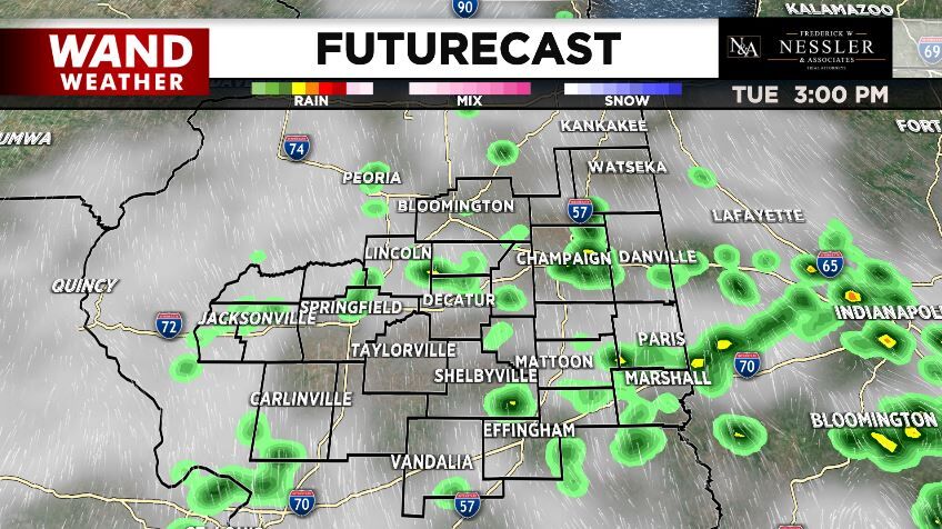
That kind of pop-up type thunderstorm activity will be with us Tuesday, Wednesday, and into Thursday before our next cold front arrives. It won't rain at your house that whole time, but you will likely catch a couple quick-hitting showers or storms in the next few days. It's tough to pinpoint more than a couple hours ahead of time where those showers and storms will pop up within our region, so the best way to be ready for those is to download the free WAND Weather app. In it you'll find an interactive radar that can show you if a storm has popped up near you or if one is headed your way.


