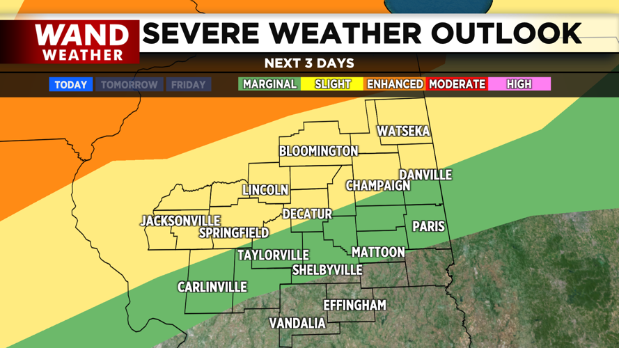


DECATUR, IL. (WAND) - Dangerously hot temperatures followed by severe weather will be on tap for the next two days. The day will start with some sunshine and warm temperatures in the 70s. Clouds will build into the area throughout the day. Storm chances will increase in the afternoon and evening. The heat index will be over 100 degrees, and this will help destabilize the atmosphere. The evening storms will be isolated, but could turn strong to severe. Winds will be the biggest threat, but hail and isolated tornadoes can’t be ruled out.
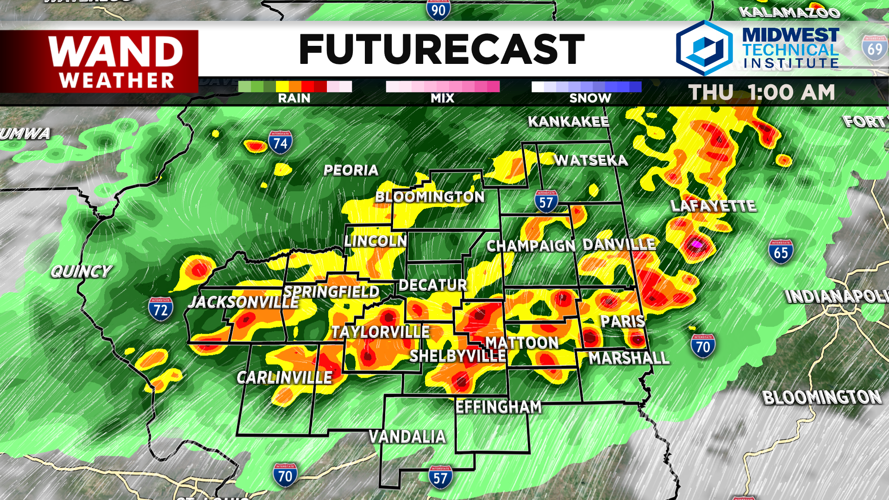
The second round of storms will arrive overnight. The models are showing an organized line of storms moving into Central Illinois around midnight. These storms will pack a punch and could produce all modes of severe weather. Storms will exit the area around 3 am Thursday.
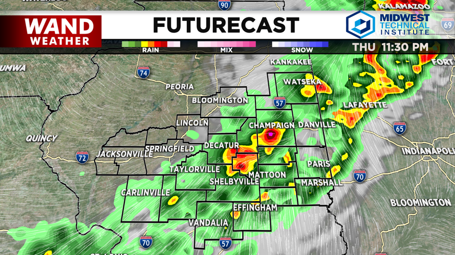
Heat and humidity will soar once again into Thursday afternoon. Actual temperatures will be in the low 90s, with the heat index above 100 degrees. One more round of potential severe storms will arrive on Thursday evening. All modes of severe weather will once again be possible through the evening.
Winds will finally flip behind the Thursday storms, and this will allow cooler and drier air to return. High temperatures will be in the low 80s on Friday with mostly sunny skies. That is right around average for this time of year.
Copyright 2026. WANDTV. All Rights Reserved.


