


The below forecast is outdated. Click here for the latest.
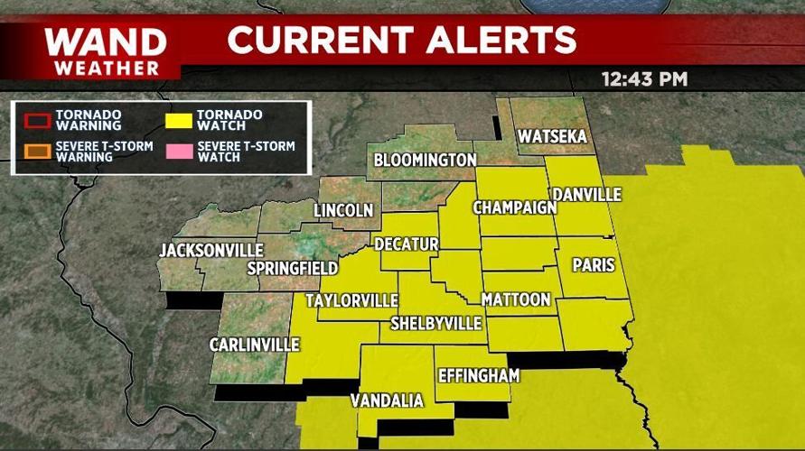
DECATUR, Ill. (WAND) - The National Weather Service Storm Prediction Center has issued a Tornado Watch for portions of central Illinois on Sunday as severe weather is expected through the afternoon.
The watch includes an area from I-55 east including Decatur, Champaign, Charleston, Effingham, Vandalia, and Taylorville. It expires at 7 p.m. Eastern Daylight Time.
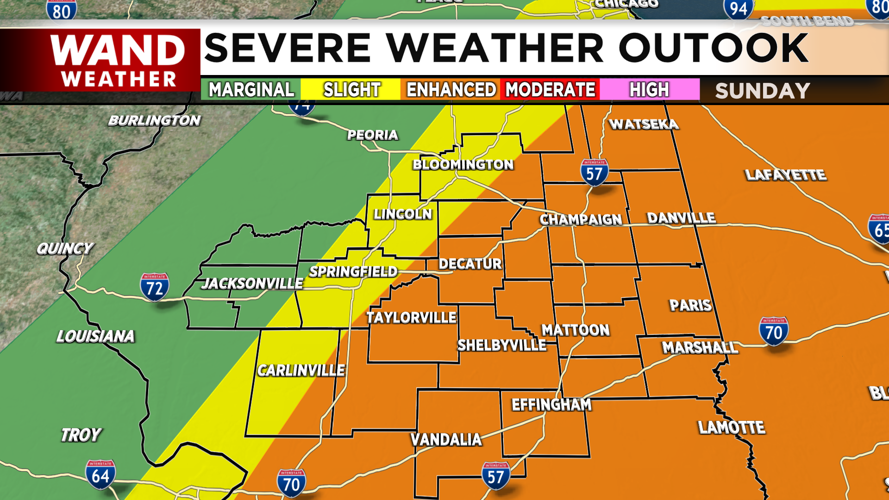
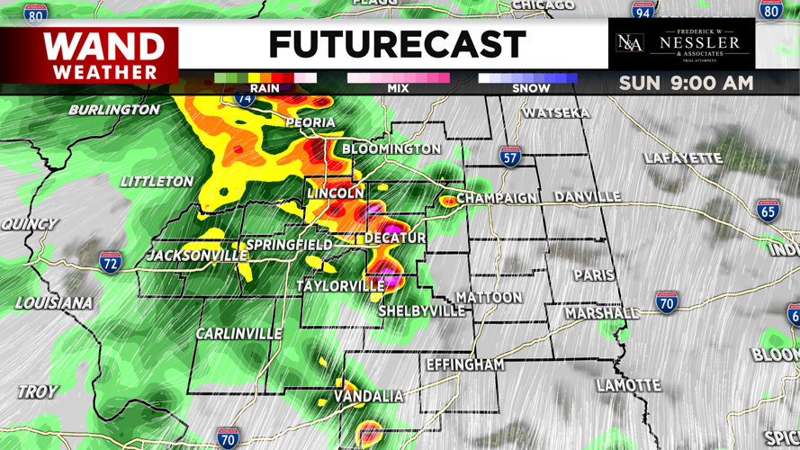
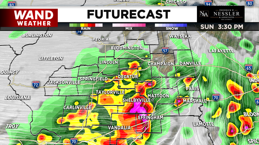
Strong storms were expected through Illinois on Sunday. An earlier round of storms Sunday morning were not severe. The second round, for the afternoon, could include hail up to 2 inches in diameter, tornadoes, and high winds.
Most of central Illinois us under a Level 3 Enhanced risk of storms. Other areas are under a Level 1 or Level 2.
Expect breezy conditions throughout today with southwesterly winds up to 25 mph while temperatures climb into the low 70s. However, temperatures will fall for tonight into the upper 30s.


