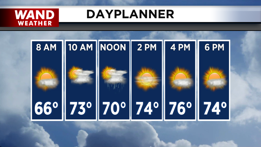
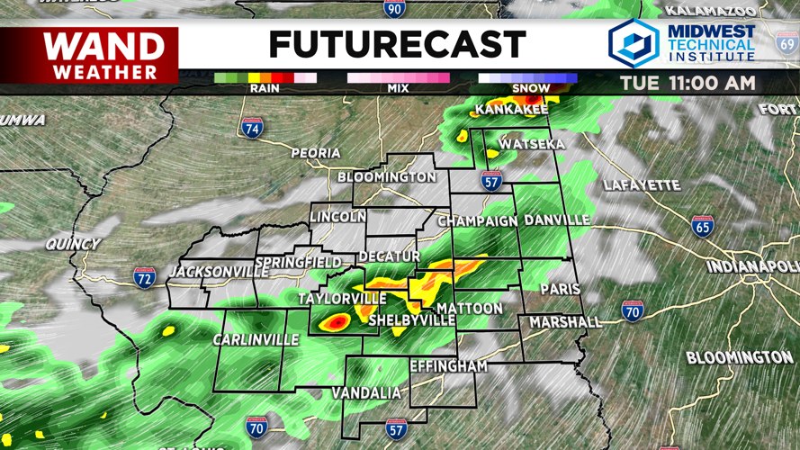


DECATUR, IL. (WAND) - Happy Tuesday! It will be a very active middle of the week as storm chances ramp up for the next two days. Expect several rounds of thunderstorms to impact the area through Wednesday evening. The first round of storms will move in later this morning. A weak cold front will move across Central Illinois through the morning. This will trigger a few scattered thunderstorms before noon. Most of these will be below severe weather limits, but a few isolated cells could be strong to severe. The storm threat for Tuesday will exit by the early afternoon.
Winds will be gusty today with gusts around 30 mph. Temperatures will warm up with mostly sunny skies behind the rain. Expect high temperatures today to be just a few degrees warmer than yesterday in the upper 70s. Temperatures will cool off overnight into the mid-50s.
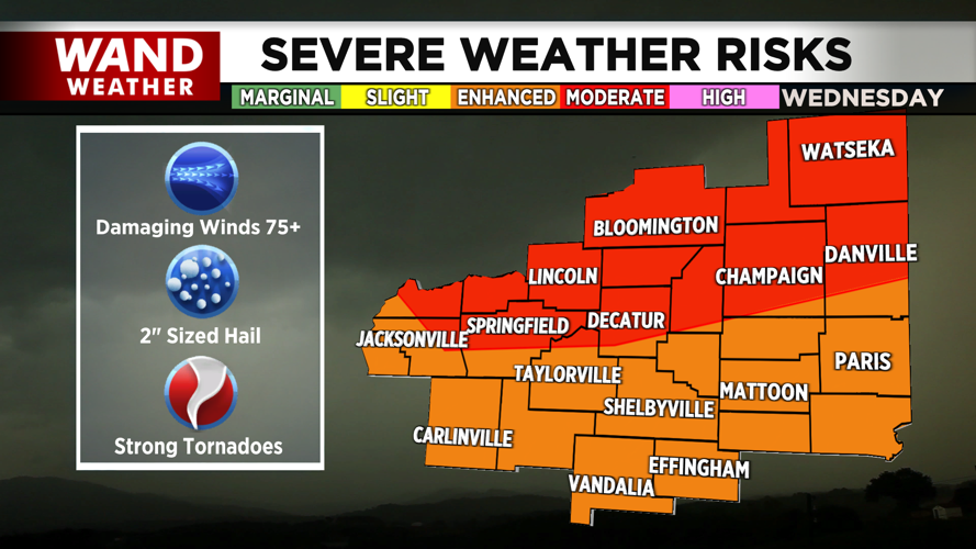
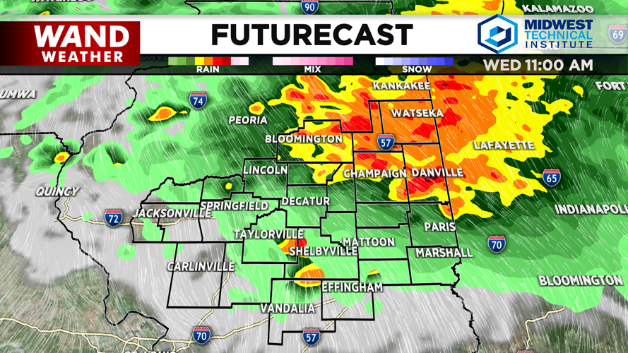
Wednesday is looking very active with dangerous storms expected to return. The first round of storms for Wednesday will impact areas along and north of I-72. These storms will linger through the morning. Winds will be the biggest issue with these morning storms.
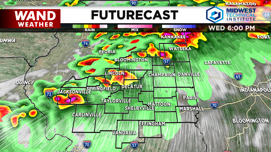
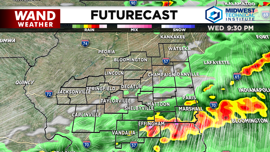
The main threat for severe weather will move in on Wednesday afternoon and evening. Expect scattered storms to develop around 4 pm. These will become organized very quickly, and a squall line is expected to form by about 6 pm. These storms will be some of the strongest we have seen this season. All modes of severe weather are possible, including wind gusts of 75+ mph, 2-inch diameter hail, and strong tornadoes. These storms will be moving very quickly, so you won’t have much time to take shelter if a warning is issued. The storms will exit the area around 11 pm.
Much calmer weather returns for the back half of the week. Temperatures will be in the 70s and low 80s through the weekend with plenty of sunshine. Rain chances will return on Father’s Day.
Copyright 2026. WANDTV. All Rights Reserved.


