
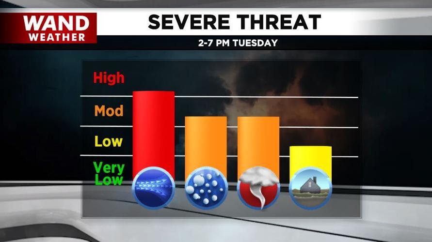
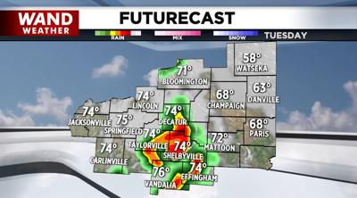
Another round of severe storms is possible across central Illinois later Tuesday.
Heavy rain moved across the area overnight into this morning dropping more than inch in many hometowns.
Scattered showers and storms today will build into severe thunderstorms this afternoon and evening.
Damaging winds, large hail, and tornadoes are possible.

Most of these storms will be between 2-7 p.m., but the storms could affect us an hour or two on either side of that timeline.
After highs in the 70s today, it'll be breezy and much cooler Wednesday and Thursday with scattered showers.
Highs will be in the low-to-mid-60s with overnight lows in the 40s.
Our best chance of seeing dry weather is Friday and Saturday with more showers and storms possible late in the Memorial Day weekend.
Copyright 2025. WANDTV. All Rights Reserved.


