


DECATUR, Ill. (WAND) - The National Weather Service has cancelled its tornado watch for central Illinois.
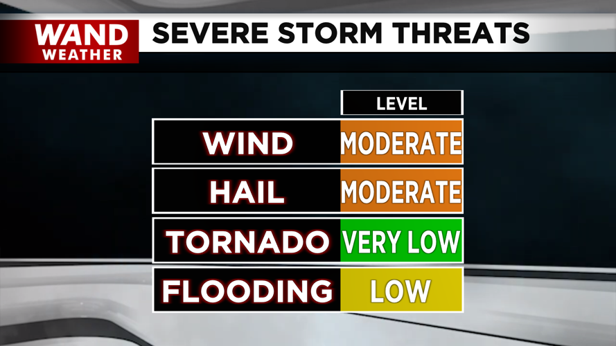
Thunderstorms continue to roll through overnight, but will be elevated, leaving us mainly under a concern for large hail and straight-line damaging winds. Convective inhibition, or the brakes on storm development, paired with a stabilizing atmosphere after our initial round of thunderstorms, will lessen the concern for tornadic activity overnight. However, we still can't rule out the chance of an isolated or short-lived tornado.
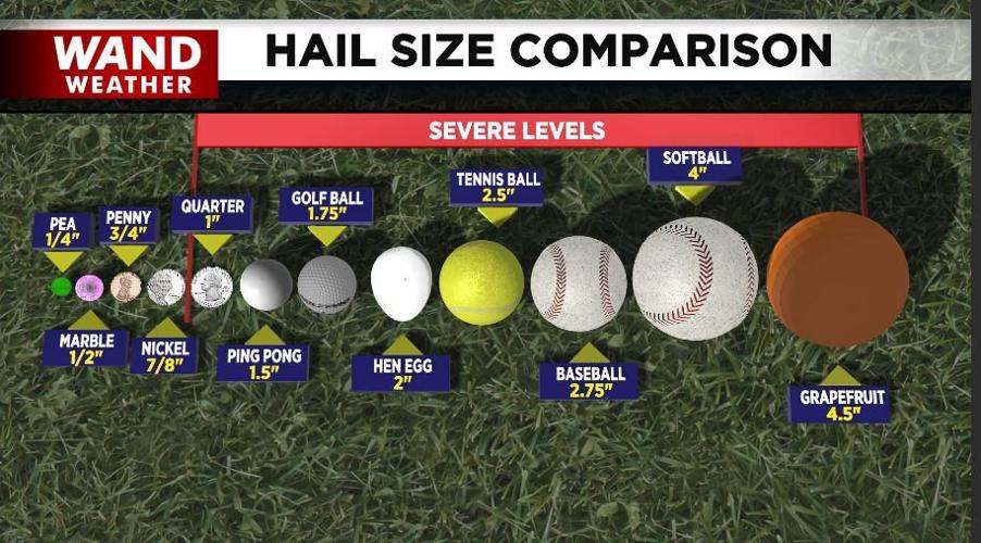
Large hail can severely damage roofs and siding, along with cars. If you have a garage or carport, use it! Reports of hail with a five-inch diameter, larger than a grapefruit, came in from the Kankakee area. If this is verified, it will set a new Illinois state record for the largest piece of hail. That speaks volumes to the intensity of this storm system.
Obviously, not everyone will experience severe weather, but many can. Since these storms are moving through overnight, you will need a way to receive the latest warnings and know how to get into your safe place on a moment's notice.
Stay safe and stay weather-aware.
Copyright 2026. WANDTV. All Rights Reserved.


