(WAND) - The first widespread frost of the season for Central Illinois is likely tonight into Wednesday morning.
We'll see a repeat Wednesday night into Thursday morning.

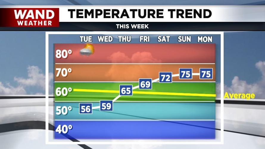
After starting out in the 30s and 40s this morning, we'll only warm into the mid-50s today under a sun and cloud mix. A few sprinkles or light showers can't be ruled out, especially across the north and east.
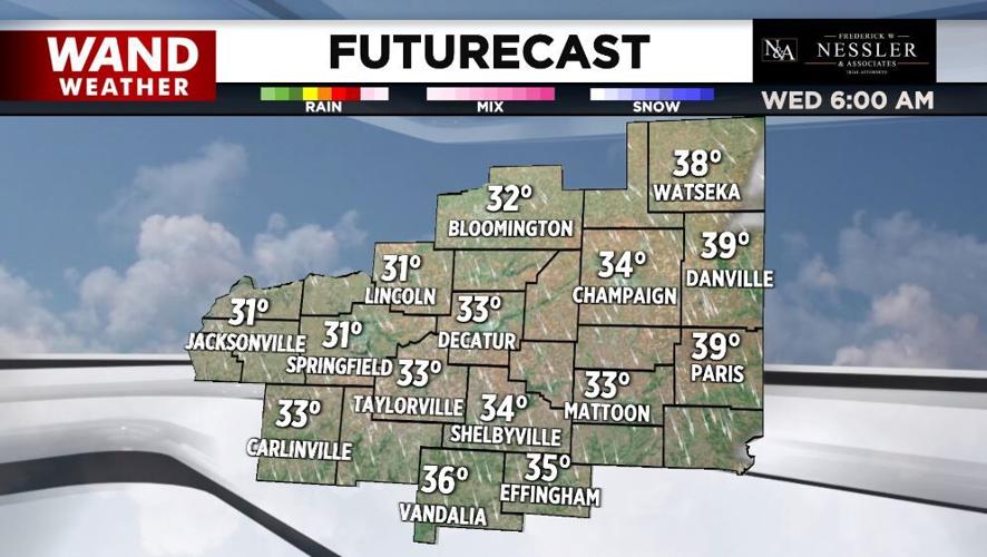
Skies clear out tonight and winds diminish allowing temperatures to plunge into the low-30s.
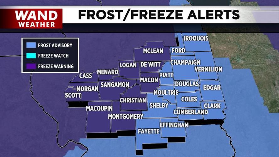
Frost and freeze alerts are in effect overnight into early Wednesday morning for all of Central Illinois.
More widespread frost is likely Wednesday night into Thursday morning.

Plenty of sunshine and a warming trend are in the forecast for the remainder of the week into the weekend.
Meteorologist Anthony Peoples
Copyright 2024 WAND TV. All rights reserved.


