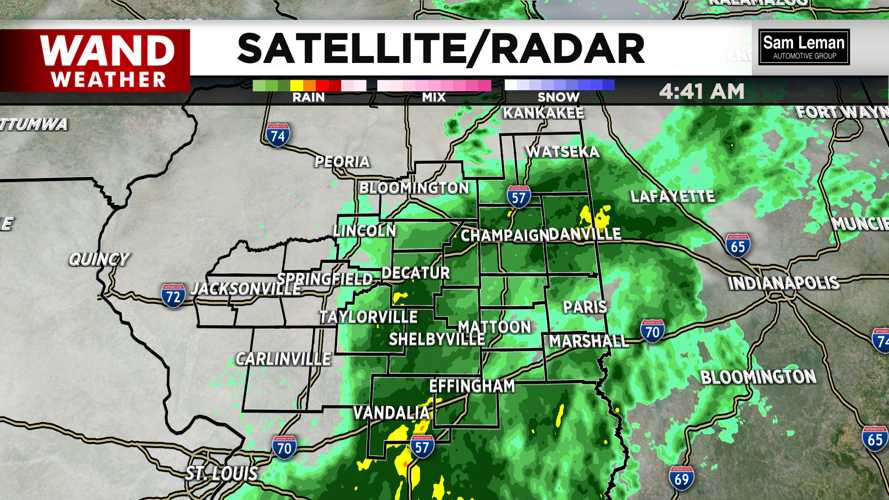
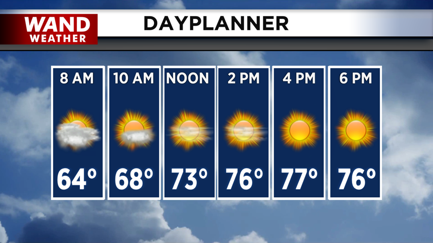


DECATUR, IL. (WAND) - Happy Thursday! The severe weather threat fell apart quickly last night. This has led to a soggy morning for most of Central Illinois. A good half inch to an inch of rain is expected through this morning. Dry conditions will take over for the rest of the day as clouds exit. Sunny skies with temperatures in the upper 70s move in for the afternoon. It will be less humid today with the sunshine and winds out of the west.
Temperatures will fall faster tonight with the mostly clear skies. Friday morning will be the coolest morning so far this week with temperatures in the 50s. Much warmer temperatures move in for the afternoon with the strong winds back out of the south. High temperatures will top off in the mid-80s with a mix of sun and clouds.
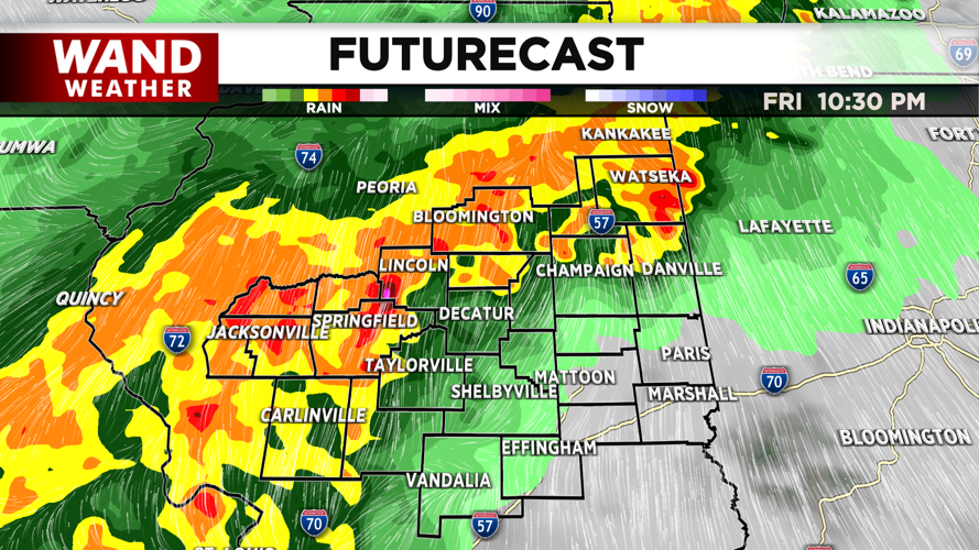
All eyes are on Friday night and early Saturday morning. A cold front will slide in from the west late Friday. This will trigger strong to severe thunderstorms through Saturday morning. All modes of severe weather are possible with these storms. The storms will exit Saturday morning, and winds will finally be out of the northwest. This will lead to much cooler temperatures for the weekend.
High temperatures will be in the 50s for Saturday and Sunday afternoon. Next week is looking fantastic with temperatures in the 60s and 70s with a slow warming trend. Expect abundant sunshine for much of next week.
Copyright 2026. WANDTV. All Rights Reserved.


