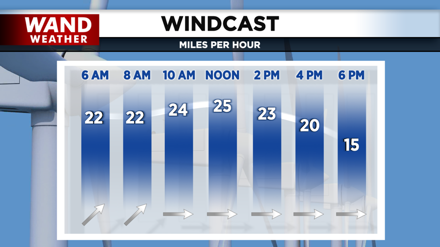


DECATUR, IL. (WAND) - Happy Friday! The winds are howling today with gusts around 40 to 50 mph. Temperatures are slightly warmer than yesterday, but with the gusty winds, it will feel cooler through most of the afternoon. Winds will die down, and we should have some comfortable temperatures in the 50s for the evening.

Temperatures will drop quickly tonight with clear skies. Expect overnight lows in the low 30s with a mix of rain and flurries. Mostly cloudy skies hang around Saturday with temperatures warming up into the mid-50s.


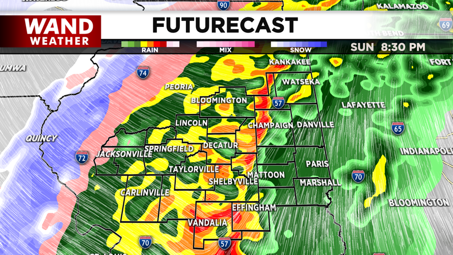
All eyes are on Sunday as temperatures will warm up quickly into the mid to upper 60s. A strong cold front will move across the region on Sunday afternoon. This will bring in another good chance for strong to severe thunderstorms through the evening. The best chance for severe storms will be along and east of I-57.

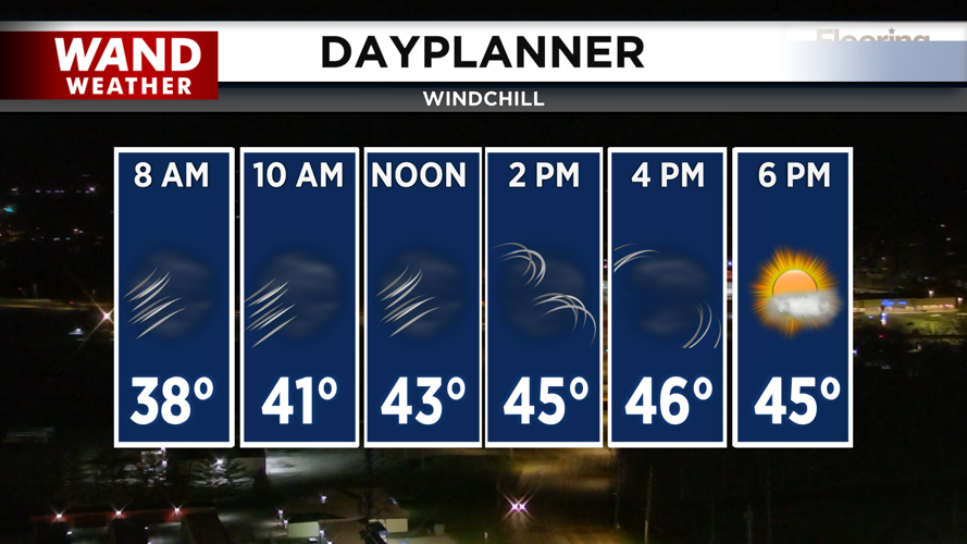
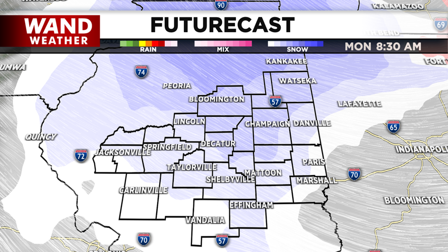
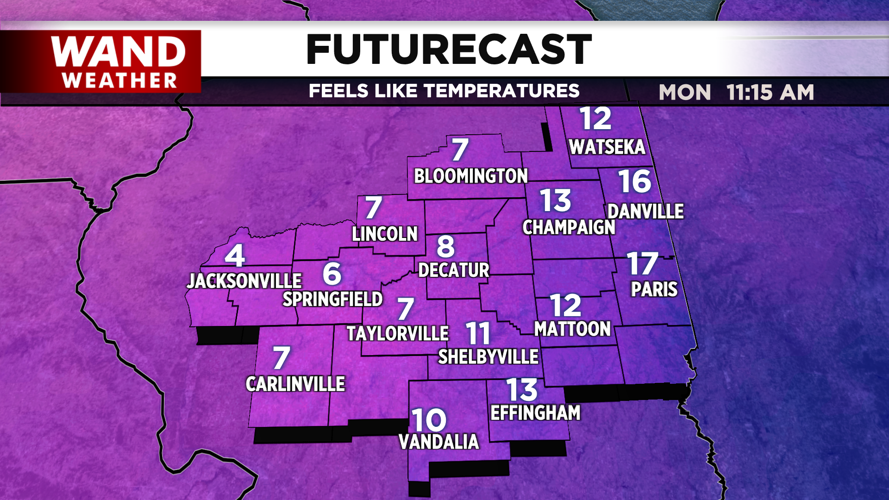
These storms will also bring in bitterly cold air for the evening. This will cause the rain to transition to moderate snow overnight into Monday morning. Accumulation looks low, but some slick spots are expected. Temperatures will plunge with the snow. Expect wind chills in the low single digits near 0 for Monday and Tuesday morning.

Warmer temperatures build in through the week, with 60s returning by the end of the week. Have a great weekend!
Copyright 2026. WANDTV. All Rights Reserved.


