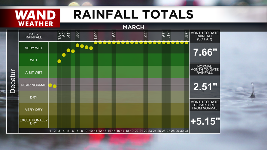
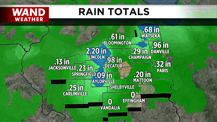
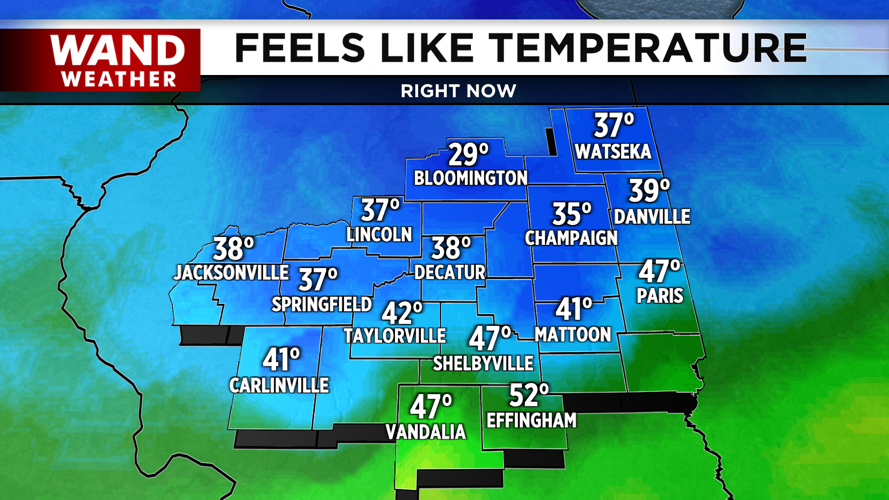


DECATUR, IL. (WAND) - Happy Wednesday! Heavy thunderstorm activity rolled through Central Illinois Tuesday night into Wednesday morning. Several severe thunderstorm warnings were issued, but there were very few damage reports in these storms. Temperatures have plunged behind the rain, and it is 20 degrees cooler than yesterday morning, with most of Central Illinois in the 40s.
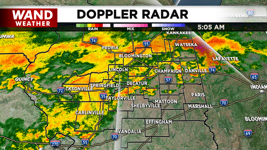
Steady to heavy rain will hang around through the morning. Some thunderstorm activity is possible, but the threat for severe weather is over for now. Rain will exit eastward today through the morning, and there should be a lull in the rain this evening.
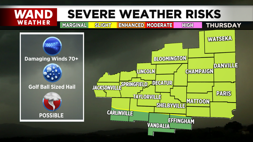
Severe weather chances will return on Thursday with a warm front lifting across the region. This could trigger severe thunderstorms overnight into Thursday morning. Storm chances will linger Friday into Saturday as another front moves through. This will cause temperatures to fluctuate dramatically over the next few days.
Highs will be in the 70s on Thursday and Friday. A cold front will impact Central Illinois this weekend. This will trigger more showers and storms. It will also cool temperatures down into the 30s by Easter Sunday morning. Easter is looking dry, but chilly and windy.
Copyright 2026. WANDTV. All Rights Reserved.


