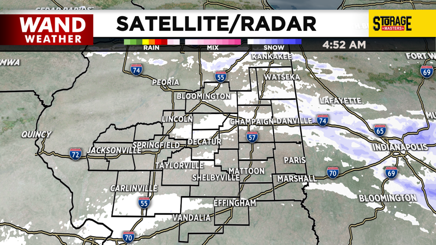

DECATUR, IL. (WAND) - Happy Tuesday! Some light snow is moving across Illinois this morning, but it is staying north and east of Central Illinois. Areas north of I-74 could see a light coating, but we don’t expect to have much in the way of travel impacts through the afternoon.
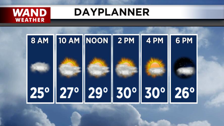
Temperatures will be similar to yesterday, with highs topping off in the low 30s. Sunshine should poke through the clouds by the time we get to the afternoon, with winds staying fairly calm. Colder temperatures will return overnight as clouds build into the area.
Temperatures will stay below average for the rest of the week, with highs in the mid to upper 20s on Wednesday. Above freezing temperatures will return for the back half of the week. Temperatures will climb close to 40 degrees by the time we get into Friday, but wind chill factors will still make it feel chilly outside.
Temperatures will dip briefly this weekend into the 30s. Much warmer temperatures are expected to move in for next week.
Copyright 2026. WANDTV. All Rights Reserved.


