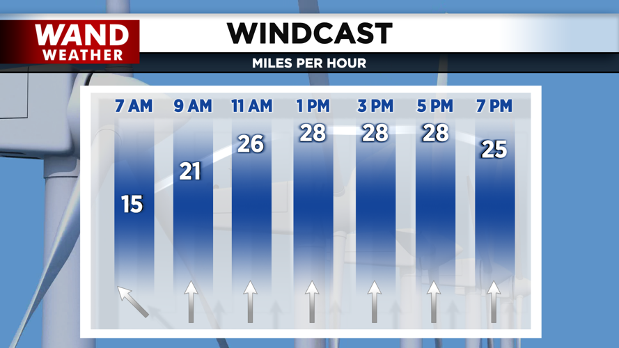
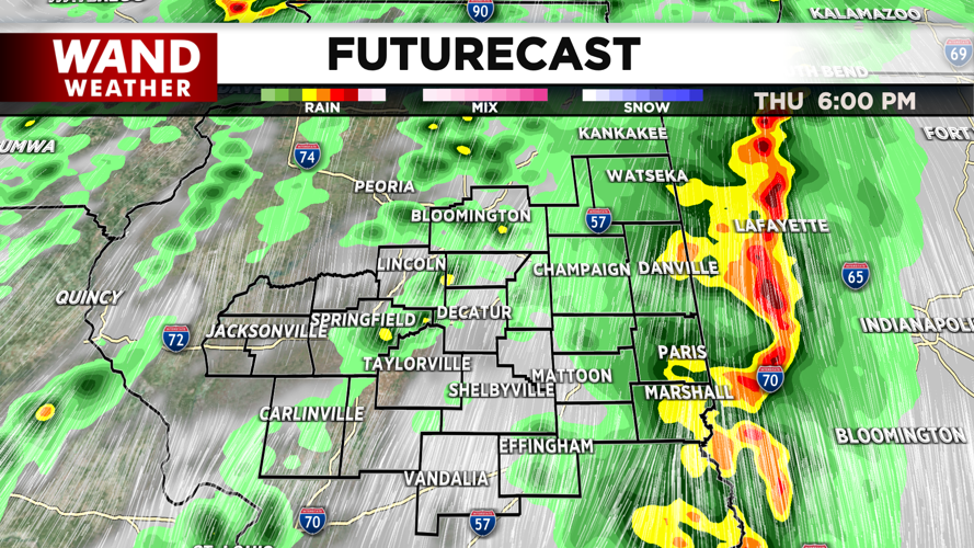
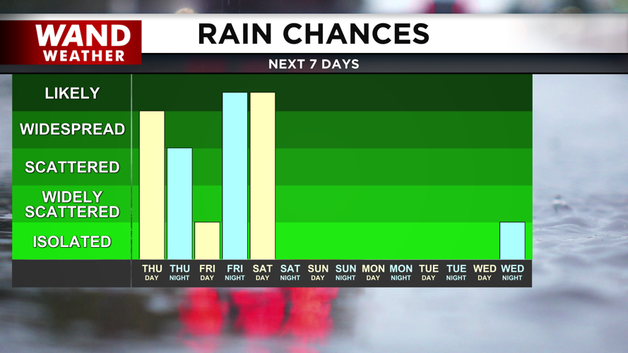


DECATUR, IL. (WAND) - A windy and stormy Thursday is on tap for us here in Central Illinois. A warm front is lifting across Central Illinois. This will allow temperatures to soar into the 70s this afternoon as very strong winds out of the south take over. A wind advisory will be in place for most of the state until 7 this evening. Expect wind gusts to be over 45 mph through the evening.
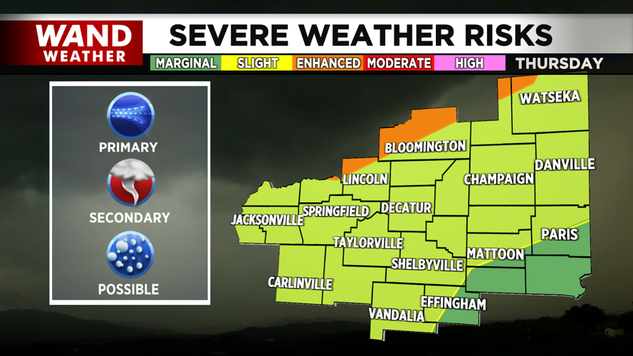
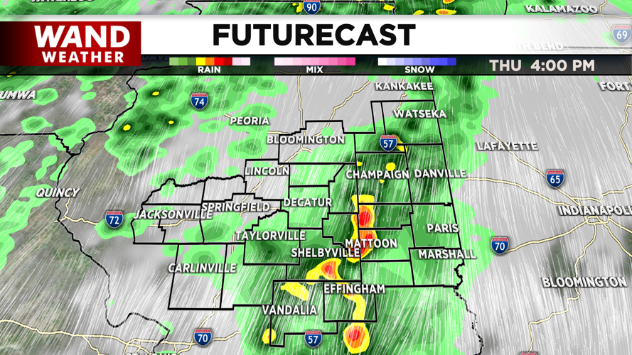
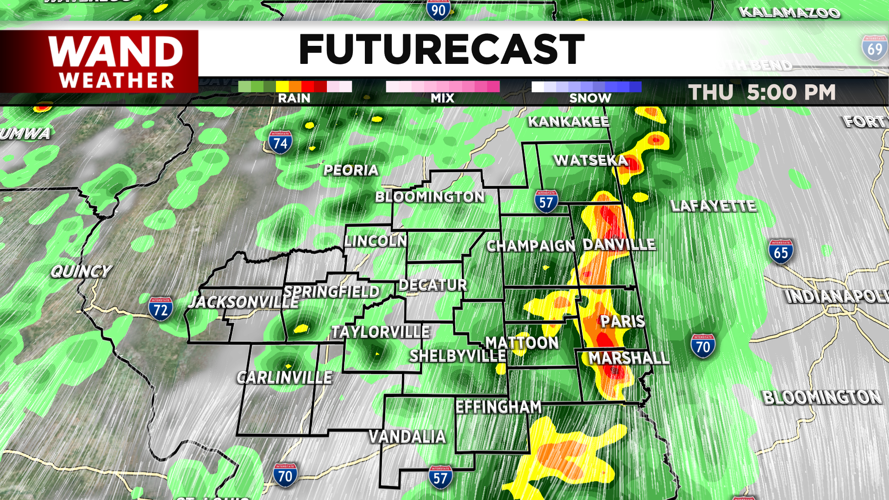
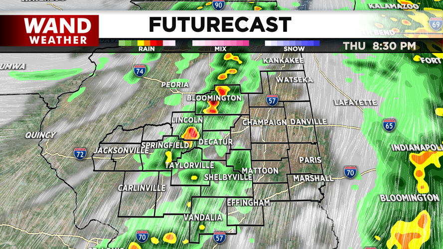
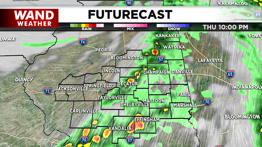
The severe weather risk will ramp up through the afternoon. Most of Central Illinois is under a slight (level 2 out of 5) risk for severe weather. The storms will be moving through the area between 2 and 10 pm. All hazards are in play, but the main threat will be wind gusts of 70+ mph. Strong tornadoes cannot be ruled out with these storms, so be weather aware this afternoon.
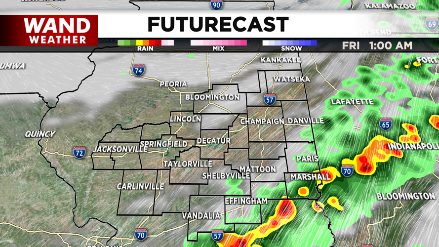
Storms will exit Thursday night, but temperatures will stay warm in the 50s for Good Friday morning. Another round of storms will move in on Friday afternoon, but these look more scattered and won’t be as strong as Thursday. The severe weather risk will ramp up Friday evening into the overnight hours.
A line of storms will push through Illinois through early Saturday morning. This will lose steam the further east it goes, but areas west of the Illinois River could see storms hit severe weather limits. Damaging wind and hail will be the big threats on Saturday morning.
Heavy rain will linger behind the storms. Showers will exit Central Illinois from west to east on Saturday. Dry conditions should return to the area for the afternoon. Temperatures will plunge behind this rain. Expect overnight lows to drop into the mid-30s. Temperatures will stay cool on Easter Sunday, but the 50s return by the afternoon.
Copyright 2026. WANDTV. All Rights Reserved.


