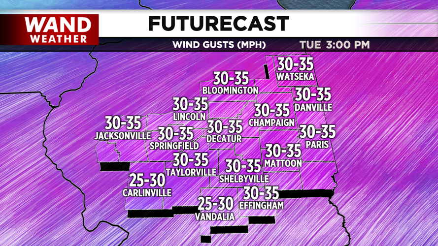
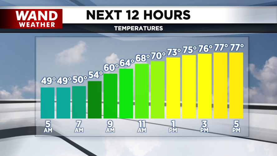


DECATUR, IL. (WAND) - Happy Tuesday! Temperatures hit the low 60s again on Monday, but we will be much warmer for the rest of the week. Temperatures today will soar with strong wind gusts out of the southwest. High temperatures will hit the upper 70s this afternoon.
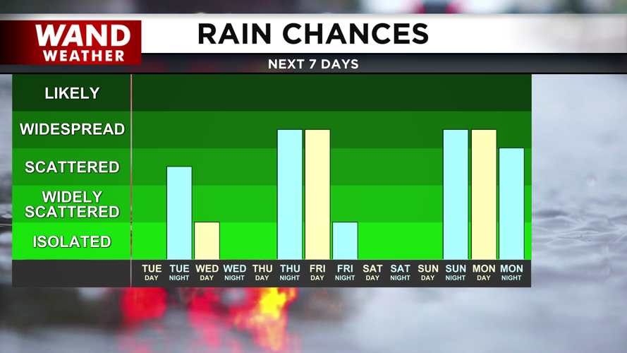
Temperatures will stay warm overnight as chances for scattered showers and a few storms move in from the north. A low-pressure system will track across the Great Lakes tonight and drag a cold front along with it. This could trigger a few storms overnight into early Wednesday morning.
Most of the area is looking dry on Wednesday, but there is a low chance that a few storms will develop east of I-57 in the afternoon. The winds will continue out of the southwest through Thursday. This will keep temperatures warm for the rest of the week.
The next chance for more widespread rain will move in Thursday night into Friday. A cold front will bring some heavy rain and thunderstorms into the area through most of the day Friday. Some severe thunderstorms are possible; however, the biggest risk will stay further west. Dry and seasonable conditions will take over for the weekend.
Copyright 2026. WANDTV. All Rights Reserved.


