

DECATUR, IL. (WAND) - Central Illinois is in for a dramatic weather shift starting Wednesday. After a warm and unsettled Tuesday, a cold front will sweep through the region, ushering in noticeably cooler, drier conditions that will stick around through the end of the workweek.
Tuesday: Warm with Scattered Storm Chances
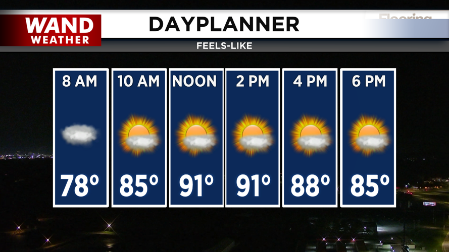
Tuesday will feel like summer isn't quite ready to leave. Highs will climb into the upper 80s, but with humidity factored in, it'll feel closer to the low 90s — so dress for the heat during your commute and outdoor plans.
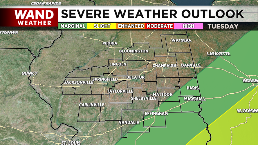
A warm front has already pushed east of Central Illinois, placing the region in the warm sector. While storms are staying mostly to the west and east this morning, scattered storms remain possible through early afternoon — though they'll be hit or miss across the area. The Storm Prediction Center has outlined a Marginal Risk for most of the region, with a small Slight Risk for far southeastern counties. At this point, confidence remains low that storms will significantly impact Illinois.
What to do: Keep an eye on the forecast through early afternoon. If you're heading outside, have a way to check for updates, and remember an umbrella wouldn't hurt just in case.
Wednesday-Friday: A Fall-Like Pattern Takes Over
Here's where things change dramatically. Temperatures will drop quickly into the low 60s Tuesday night under mostly clear skies. By Wednesday, a sprawling Canadian high-pressure system will move southeast across the Midwest, bringing drier conditions and noticeably cooler air.
Expect highs in the mid to upper 70s Wednesday through Friday — a welcome break from the summer heat. These will be picture-perfect fall-like days with no measurable precipitation expected through Thursday.
Looking Ahead: Warm-Up Returns
By Thursday night, a weak signal for storms develops to the west, bringing a 20-30% chance of showers and storms on Friday west of Fulton County to Shelby County—nothing significant, but worth monitoring.
A warming trend will take over next weekend as the surface ridge shifts east, allowing warmer southerly winds to return. Summer isn't quite done with us yet.
Copyright 2026. WANDTV. All Rights Reserved.


