
DECATUR, IL. (WAND) - Happy Friday! The heaviest of the snow has moved across Central Illinois, leaving us with slick roads for much of the area. Totals have ranged from a half inch to about an inch for most of the region. Travel impacts are the main concern, but temperatures will warm up above freezing this morning. This will help melt the snow, and roads should improve quickly.
Some scattered flurries with a mix of rain are possible through the afternoon and evening, but the accumulation is looking very light with no additional snowfall expected. This cold front will drive in cold air, and the dangerous chill will be the big story through the weekend.
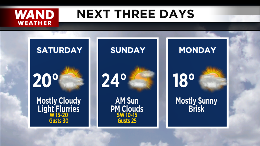
Temperatures will drop into the teens overnight tonight, and it won’t warm up much at all through Saturday afternoon. Expect highs right around 20 degrees, with wind chills staying in the single digits. Temperatures will stay steady through Tuesday of next week, with high temperatures staying below freezing.
Stay warm and have a great weekend!
Copyright 2026. WANDTV. All Rights Reserved.


