


DECATUR, IL. (WAND) - A dangerous heat wave is settling over Central Illinois, bringing life-threatening conditions through midnight Thursday. An Extreme Heat Warning is in effect, and residents need to take this seriously.
What to expect:
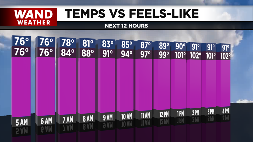
Wednesday and Thursday will be nearly identical, with highs near 93 degrees. But the real story is the heat index — that's what it will feel like outside. Expect heat index values between 105 and 110 degrees both days. That kind of heat can cause heat exhaustion and heat stroke in just minutes, especially for young children, older adults, and pets.
Conditions will be mostly sunny on Wednesday and Thursday with just a few hazy clouds, which means plenty of sunshine to drive those temperatures even higher.
What you need to do:
Stay indoors during peak heat hours (10 a.m. to 4 p.m. if possible)
Drink plenty of water — even if you don't feel thirsty
Never leave children or pets in vehicles, even with windows cracked
Check on elderly neighbors and relatives
If you must be outside, wear light-colored, loose-fitting clothing and sunscreen
Take frequent breaks in air conditioning
Looking ahead:
The heat will begin to ease slightly on Friday through Sunday, but it won't disappear. Friday's high will be 92 with a heat index around 105. Saturday will see a high of 91 with a heat index near 100. Sunday will be the coolest day of the extended period with a high of 88 and a heat index in the upper 90s.
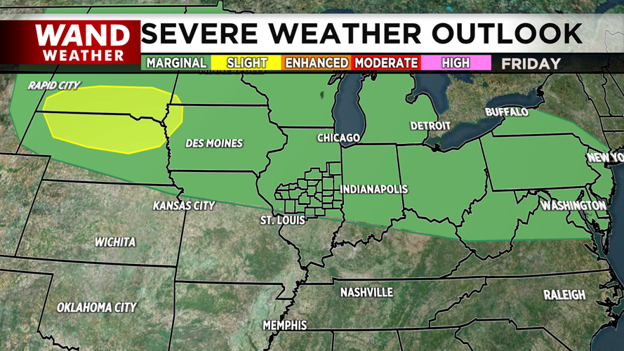
However, Friday afternoon brings another concern: isolated strong to severe storms could develop. These storms will be hit or miss, but some could pack a punch. Saturday's storm chances increase, with scattered storms possible in the afternoon and evening. Some of these storms could bring heavy rain — something to keep in mind if you're planning to attend July 4th fireworks shows.
Next week will be cooler but very unsettled. Scattered storm chances will stick around every day through next Tuesday, so stay with us for updates.
Copyright 2026. WANDTV. All Rights Reserved.


