

DECATUR, IL. (WAND) - It’s going to be an interesting week ahead for the Midwest as another potential winter storm bears down on the region. At the surface, things appear calm as a strong high-pressure system moves in to dominate the region Thursday night into Friday. But this will usher in another blast of arctic air.

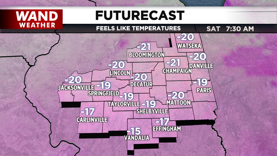
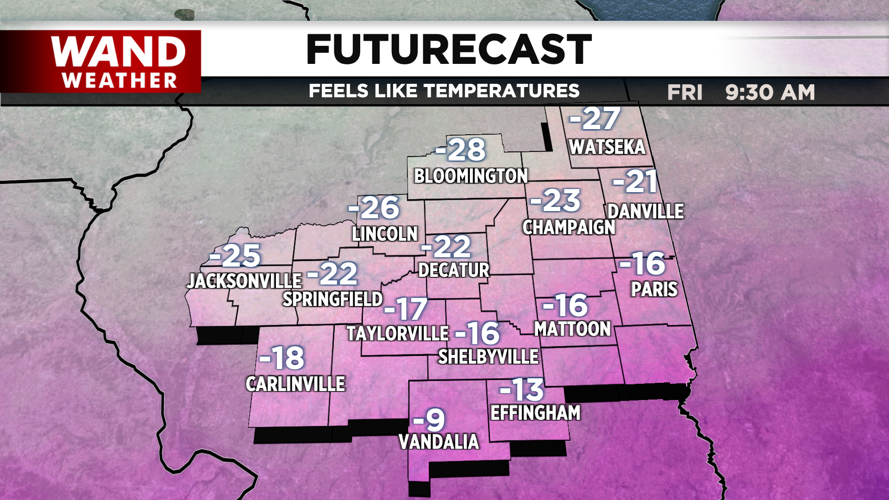
Actual air temperatures will dip close to 0 by Friday morning. Friday afternoon will only warm up into the single digits. Overnight lows will plunge below 0, so wind chill values on Saturday morning could be in the negative 20-degree range.
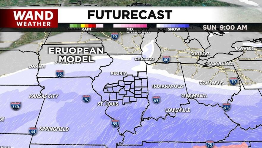
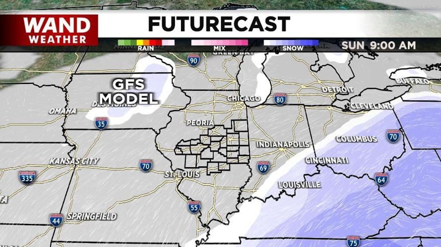
While the cold air will impact everyone, the chances of snow are still in question for much of Central Illinois. The stable air will break down Saturday into Sunday as a big winter system to our south tries to move northward.
The chances are still low for accumulating snow, but some models are starting to show snow moving north of I-70 by midday Sunday. The European model is suggesting some accumulation, while others, like the GFS, are showing the snow staying in Southern Illinois.


We will monitor this system closely over the next few days to see how the midrange models handle the snow chances. Prepare for a major drop in temperatures regardless of the snow.
Copyright 2026. WANDTV. All Rights Reserved.


