

DECATUR, IL. (WAND) - Severe weather possible after 7 p.m., especially north of I-74
Central Illinois will enjoy a pleasant Friday morning and afternoon before severe thunderstorms move in this evening, bringing the possibility of hail, damaging wind, and isolated tornadoes to parts of the region.
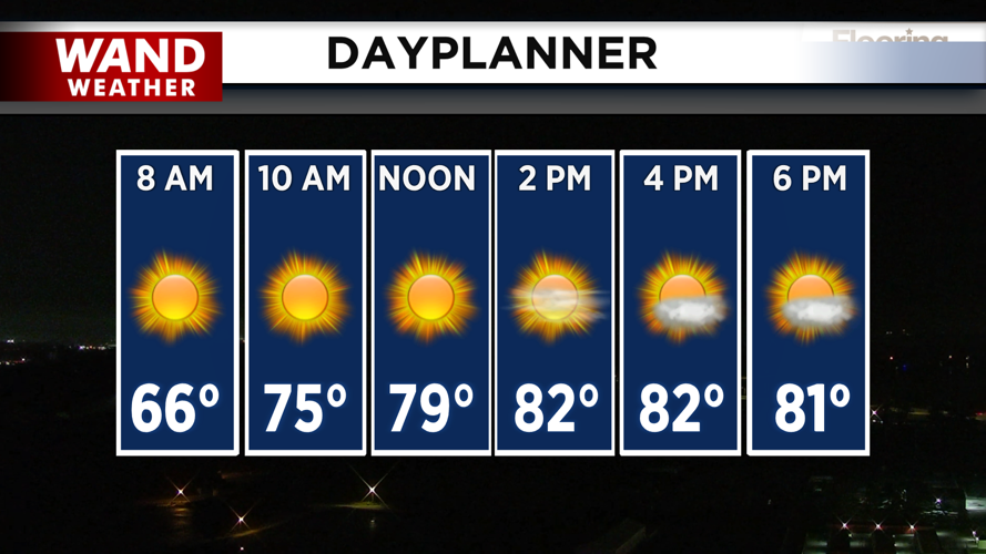
Expect a mostly dry and sunny day through the afternoon. Weak high pressure will keep conditions mild, with temperatures climbing into the low 80s. It's a great day to be outside — just keep an eye on the sky as evening approaches.
Storms arrive this evening
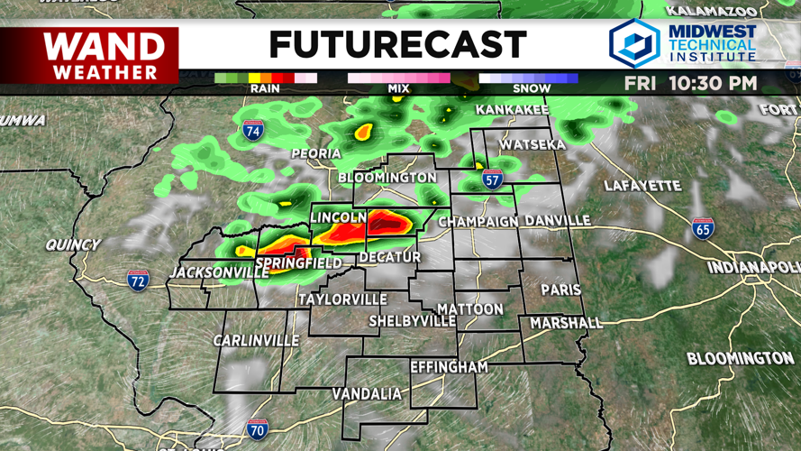
A weak cold front combined with an upper-level disturbance will trigger storm development this evening. The first storms are expected to develop in northern Illinois and eastern Iowa early in the afternoon, then drift south-southeast through Central Illinois during the late afternoon and evening hours.
Most storms will impact Central Illinois between 7 p.m. and midnight. The latest forecast models show the main threat arriving closer to 10 p.m., but storms could appear as early as 7 p.m. If you're planning to attend high school football games, stay weather aware and have a way to receive warnings.
Severe threat concentrated north of I-74
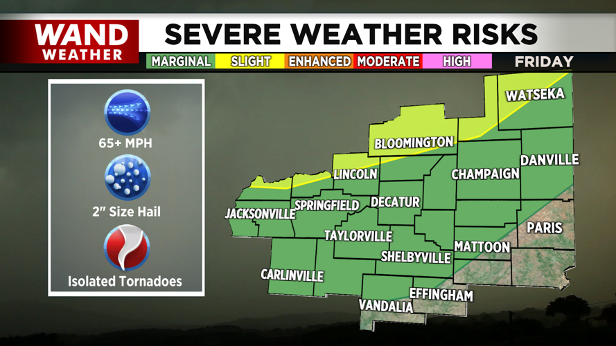
A Slight Risk of severe thunderstorms exists north of a line from Beardstown to Lincoln to Gibson City. In this area, the primary threats include:
Hail (15% probability)
Damaging wind (15% probability)
Isolated tornadoes (2% probability)
Areas further south, including Vandalia and Effingham, are under a Marginal Risk for severe storms, with lower probabilities for severe weather.
Saturday looks much better
Storms will wind down by midnight or shortly after the cold front moves through. Saturday will be a significant improvement with sunny skies and light northwest winds. Temperatures will rebound into the low 80s during the afternoon, though a few isolated storms are possible (10% or less probability) in Central Illinois during Saturday afternoon.
Cooler trend continues into next week
Northwesterly flow aloft will continue through the weekend and into next week, keeping temperatures below average. Expect highs in the upper 70s through the weekend and early next week.
Copyright 2026. WANDTV. All Rights Reserved.


