

DECATUR, IL. (WAND) - Showers and storms are moving into Central Illinois this morning as a cold front stalls out over Northern Illinois, bringing several rounds of wet weather over the next few days.
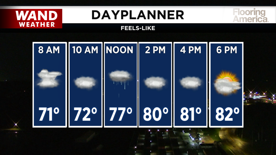
Showers are already moving in from Missouri and will spread eastward across Central Illinois over the next several hours. The heaviest rain will stay along and south of the I-72 corridor. While no severe weather is expected with this morning's showers, heavy downpours could slow your morning commute, so give yourself extra time as you head out the door.
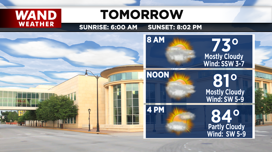
The good news: widespread rain will exit the area by noon. A few isolated showers and storms can't be ruled out through the evening, but most of the area will stay dry. Temperatures will remain below average in the low 80s with mostly cloudy skies this afternoon. Overnight, it will stay mild in the upper 60s.
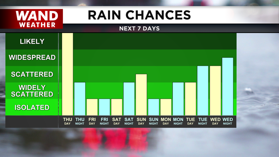
Rain chances continue Friday
Scattered storm chances will stick around Friday as temperatures warm up quickly into the mid 80s by afternoon. If you have outdoor plans, keep an eye on the forecast for updates.
Heat and humidity build into the weekend
Saturday is looking mostly dry as humidity builds into the region. High temperatures will reach the mid 80s, but it will feel more like the low 90s when you factor in the humidity.
Scattered storm chances will return Sunday with hot temperatures climbing into the upper 80s and low 90s. The heat will continue through Monday before cooler temperatures finally return for the end of next week.
Copyright 2026. WANDTV. All Rights Reserved.


